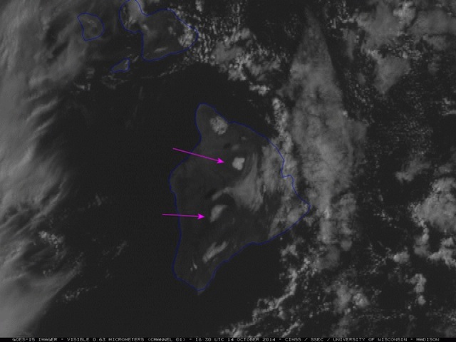
McIDAS images of GOES-15 (GOES-West) 6.5 µm water vapor channel data showed an upper-level low that moved from east to west over the Hawaiian Islands during the 13 October - 14 October 2014 period. This low forced the development of widespread showers and thunderstorms, especially over the Big Island of Hawai'i - and even produced some snowfall in the highest elevations around the summits of Mauna Kea and Mauna Loa.
Some excerpts from Area Forecast Discussions issued by the National Weather Service at Honolulu on 13 October:
FXHW60 PHFO 131350Source: the CIMSS Satellite Blog
AFDHFO
AREA FORECAST DISCUSSION
NATIONAL WEATHER SERVICE HONOLULU HI
400 AM HST MON OCT 13 2014
[...]
FORECAST MODELS HAVE BEEN CONSISTENTLY CALLING FOR 500 MB TEMPERATURES BETWEEN -12 AND -13C WITHIN THE CORE OF THE COMPACT UPPER LOW. THIS IS EXCEPTIONALLY COLD FOR OCTOBER
[...]
FORECAST MODELS SHOW THAT THIS FEATURE WILL HOLD AS IT MOVES OVER THE BIG ISLAND LATER TODAY INTO TONIGHT...LIKELY PRODUCING ACCUMULATING SNOW OVER THE SUMMITS ABOVE 12000 FT. AS A RESULT...A WINTER WEATHER ADVISORY HAS BEEN ISSUED.
[...]
=====
FXHW60 PHFO 140152
AFDHFO
AREA FORECAST DISCUSSION
NATIONAL WEATHER SERVICE HONOLULU HI
330 PM HST MON OCT 13 2014
[...]
THE SUMMITS OF THE BIG ISLAND HAVE BEGUN TO REPORT SNOWFALL ACCUMULATION...AND THIS WILL CONTINUE WITH A COUPLE OF INCHES POSSIBLE OVERNIGHT.
[...]


Reader Comments
to our Newsletter