OF THE
TIMES
"We have about 50% of the world's wealth but only 6.3% of its population. This disparity is particularly great as between ourselves and the peoples of Asia. In this situation, we cannot fail to be the object of envy and resentment. Our real task in the coming period is to devise a pattern of relationships which will permit us to maintain this position of disparity without positive detriment to our national security. To do so, we will have to dispense with all sentimentality and day-dreaming; and our attention will have to be concentrated everywhere on our immediate national objectives. We need not deceive ourselves that we can afford today the luxury of altruism and world-benefaction."
~ US State Department, 1948
Where did this person think she was? She should have had more respect for the locals she was walking amongst. The Indian people don't take too...
If the UN wants to be truly democratic, there should be no vetoes, simple as. The present UN system is by design. Its failures to prevent war are...
I like watching the near death testimonies on [Link] and on:[Link]
I can see this coming soon to a country near you. Anyone who does not comply will be accused of violating someone else's rights.
Play in the dirt you're gonna get dirty. Quit whining and take your well-deserved lumps. LOL
To submit an article for publication, see our Submission Guidelines
Reader comments do not necessarily reflect the views of the volunteers, editors, and directors of SOTT.net or the Quantum Future Group.
Some icons on this site were created by: Afterglow, Aha-Soft, AntialiasFactory, artdesigner.lv, Artura, DailyOverview, Everaldo, GraphicsFuel, IconFactory, Iconka, IconShock, Icons-Land, i-love-icons, KDE-look.org, Klukeart, mugenb16, Map Icons Collection, PetshopBoxStudio, VisualPharm, wbeiruti, WebIconset
Powered by PikaJS 🐁 and In·Site
Original content © 2002-2024 by Sott.net/Signs of the Times. See: FAIR USE NOTICE
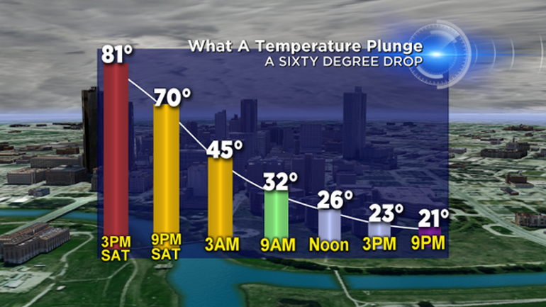
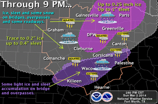
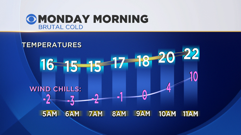
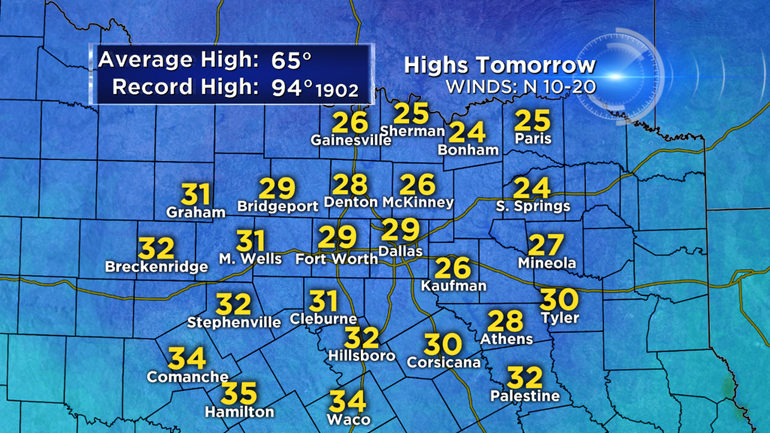
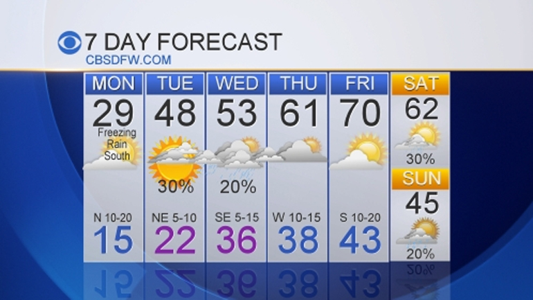
Day before yesterday I was standing beside our peach tree in shorts and flip flops looking at it's new flower buds. Last night was 21 degrees with 35mph winds. This winter was/is a game changer for way of life here at our home. Our year will be focused on becoming more prepared for next winter. All of our infrastructure is designed for the hot summers and not constant freezing. The low temps are not abnormal here, what is unusual is the amount of freezing at such low temps.
Even though I am thankful spring is almost here, I am expecting late freezes to continue longer than is normal. I would not be surprised to hit the high 90's before wildly swinging back to a freeze. Really hard to get used to heat or cold when such extreme changes in temps occur.