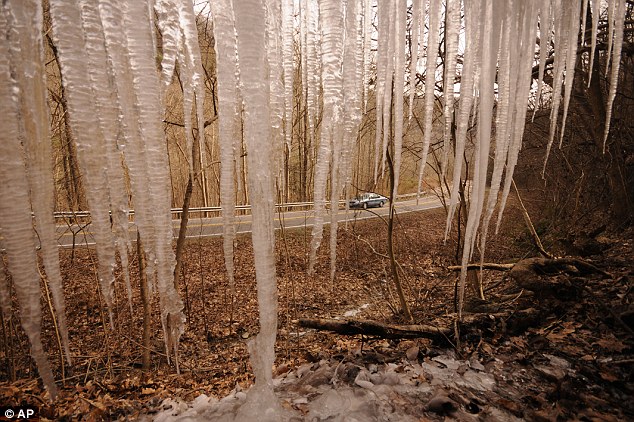
- Meteorologists are forecasting yet another snow storm for the East Coast, which will arrive on Monday
- First Super Bowl to be held in open-air stadium set to be hit by freezing cold
- Teams on high alert game in New Jersey on February 2 could be postponed
- The Midwest will be hit with a blast as well between Friday and Saturday, which may cause dangerous roads and flight cancellations
- Yet another storm is expected to follow the storm scheduled for Monday and is set to hit just one or two days before the Super Bowl on February 2
- The championship game will be held in East Rutherford, New Jersey where workers shoveled snow all day after Tuesday's unexpected whiteout
Teams have been warned to stay on high alert for changes to the scheduling of the first Super Bowl to be played in an open-air stadium.
Temperatures have already hit record lows, at times making parts of the U.S. colder than the North Pole, and are expected to plunge in the coming days.
The timing could not be worse for one of the biggest global sporting events, which will be exposed to the full force of the elements at the MetLife Stadium in East Rutherford, New Jersey on February 2.
Eric Grubman, NFL vice president of business operations, told the Denver Post: 'We are advising teams to prepare in case a contingency plan goes into effect.'
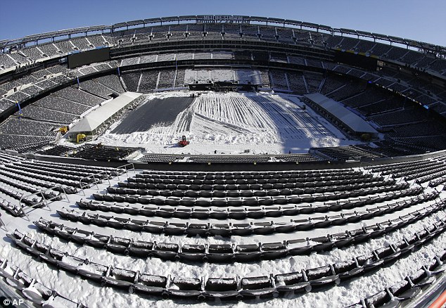
Broncos coach John Fox and Seattle coach Pete Carroll will be the first to know if the event is rescheduled.
The weather has already caused widespread disruption across great swathes of the U.S. and is set to get worse.
Matt Rogers, president of Commodity Weather Group LLC, said: 'The crazy thing is that the current cold snap this week look to be a bit more modest in the face of next week's outbreak.
'The cold coming for the end of January is sufficient to make this the coldest month of the century so far and the coldest the Lower 48 has felt in the last 20 years.'
Snow from an unexpected storm earlier in the week won't have a chance to melt before the northeast is hit with yet another blast early next week.
The first 'Alberta Clipper' storm is expected to arrive on the East Coast Monday with snow in the central Appalachians and New England a day before.
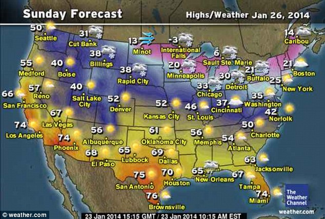
The Weather Channel reported that wind chills were in the teens in the Midwest Thursday morning. In Minneapolis, schools were closed as the mercury plunged down to -18 and a wind chill of -38.
Some parts of the region and interior Northeast will see highs in the single digits, with a few enclaves in the upper Mississippi River Valley dipping into sub-zero temperatures.
Even Texas and Tennessee - states known for their usually mild climate - are feeling the bitter cold; Houston and San Antonio were expecting ice by tonight.
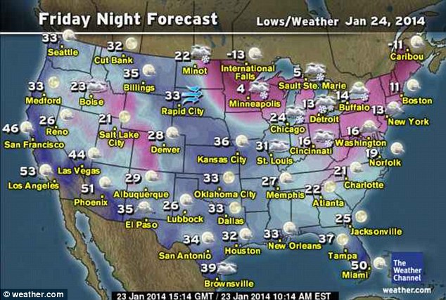
Following a temporary respite Saturday, a pair of surges of artic air will sweep down from Canada, bringing more flurries.
The storm will start off Saturday, taking a more southern route than Tuesday's storm.
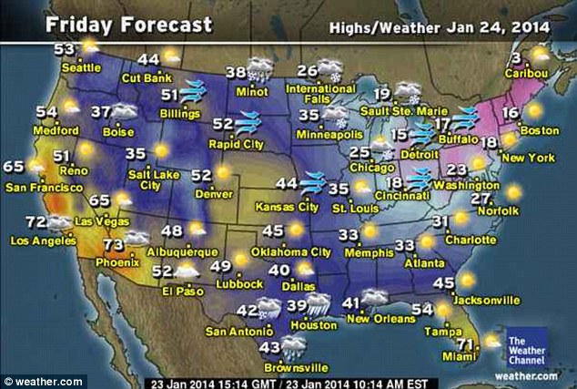
The storm will also affect the Midwest, causing possible dangerous driving conditions and flight delays in Minneapolis, Chicago, Milwaukee, Detroit, Cleveland, Pittsburgh, and Buffalo, New York.
According to AccuWeather.com Senior Meteorologist John Gresiak,'The combination of rounds of dry, powdery snow, gusty winds and low temperatures can make for whiteouts and brief blizzard conditions.'
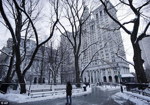
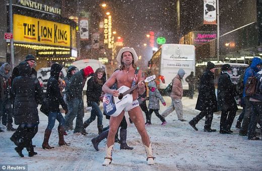
The Northeast was under attack from brutally cold weather yesterday as a winter storm swirled up the coast, creating blizzard conditions on Cape Cod, disrupting government work in Washington and leaving New York City under a foot of snow.
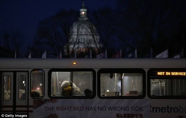
About 1,700 flights were canceled nationwide on Wednesday, according to according to flight-tracking site FlightAware.com.
Cape Cod was under a blizzard warning through Wednesday afternoon.
Boston and Philadelphia ordered schools closed on Wednesday, following the lead the day before of many districts in Pennsylvania, New Jersey, Connecticut, Virginia, West Virginia and Kentucky.
Schools also were closed on Wednesday in Rhode Island, Connecticut, upstate New York, New Jersey, Delaware, Maryland, northern Virginia and the District of Columbia.
Amtrak told passengers on its busiest line, the Northeast Corridor between Washington and Boston, to expect fewer trains. Lines serving Harrisburg, Pennsylvania, and Albany, New York, also were slowed.
In Massachusetts, Governor Deval Patrick postponed his annual State of the State address, saying he was worried about guests trying to get to the statehouse.
In New York, Mayor de Blasio's administration has been accused of being slow to react to the snow, which hit a few hours earlier than expected Tuesday. Residents on the Upper East Side in Manhattan complained that their neighborhood was being deliberately ignored by snowploughs.
One of the large glass panels at the Apple Store in midtown Manhattan appeared to have shattered after it was knocked into by a snowblower, according to a photographer.
The storm was a conventional one that developed off the coast and moved its way up the Eastern Seaboard, pulling in cold air from the Arctic.
Unlike the epic freeze of two weeks ago, it was not caused by a kink in the polar vortex, the winds that circulate around the North Pole.
The penetrating cold has the potential to cause water main breaks as far south as the Ohio Valley and mid-Atlantic and to freeze pipes into parts of the South.
The storm was blamed for at least one death in Maryland, after a car fishtailed into the path of a tractor-trailer on a snow-covered road about 50 miles northwest of Baltimore and the car's driver was ejected.
Police said the storm might have claimed more lives: A preliminary investigation showed wet conditions played a role in a two-vehicle crash that killed two people in Prince George's County, Maryland, and a tractor-trailer that jackknifed on Interstate 81 in Frederick County, Virginia, ran off the highway and hit a tree, killing the driver.
A total of three waves of arctic air will blast across the Midwest and Northeast and into next week.
The next blast of arctic air will reach the Upper Midwest by Wednesday.
While temperatures will briefly rebound in between the reinforcing waves of cold air, the rebounds will be much less pronounced from the Midwest to New England and may be barely noticeable in the northern tier states.
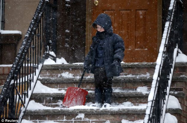
In Boston, Pittsburgh, Philadelphia, New York City and Indianapolis, temperatures may only surpass the freezing mark on one or two days through Jan. 31.
The persistent cold will cause a renewed buildup of ice on rivers in the Northern states.
Ice jams could again become a problem during the coming weeks.
At least two of the cold waves will reach into the South. In much of the South, temperatures will not be as low as that of the first week of January.
However, many areas over the interior will have multiple nights where the temperature spends multiple hours well below freezing.
Temperatures will dip to near freezing during a few nights along the upper Gulf Coast.


he is oddly quiet, not a word not a peep, silent as a mouse!