The storm was expected to peter out by the time it hits New York and Boston later in the week, but not before it creates a mess for commuters from Upper Mississippi and Ohio River valleys eastward to the Atlantic Coast.
Significant snowfall will make travel dangerous Monday night and Tuesday in the Upper Midwest, especially around major cities like Minneapolis, Indianapolis and Chicago. The Weather Channel warned that major delays were likely Tuesday at O'Hare and Midway airports.
Chicago is expected to get its biggest snowfall of the season - as much as 10 inches by Tuesday evening. The National Weather Service said accumulation rates of one to two inches an hour beginning Tuesday morning would make "snow removal difficult and travel extremely dangerous."
"Consider only traveling if in an emergency," it said in issuing a winter storm warning for the city.
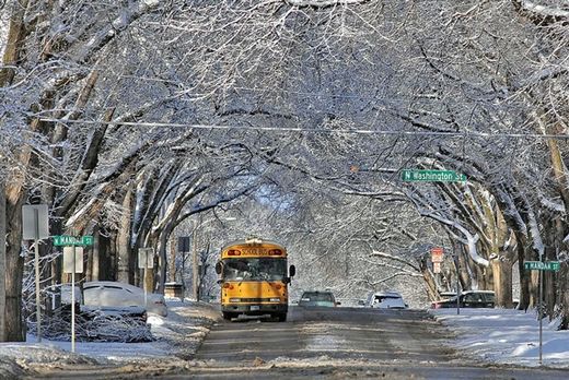
Unseasonably warm temperatures Monday melted some of the winter's snow in the Twin Cities of Minneapolis and St. Paul - just in time for a new blast of winter that could drop as much as 7 inches of new snow overnight and Tuesday.
"I'm tired of being ready for winter. I am ready for it be spring," Barbara Eckley of Minneapolis told NBC station KARE.
By Wednesday, significant accumulations were forecast for the Washington area. Major flight delays are possible at Washington-Dulles, Reagan National and possibly Baltimore-Washington International airports.
Forecasters are expecting accumulations of 8 to 10 inches of snow in the Chicago area on Tuesday with major delays at O'Hare Airport. NBC's Brian Williams reports.
While the storm isn't yet expected to hit the Northeast hard - forecasters said they'd have a better picture later in the week - the travel delays could have a noticeable ripple effect Wednesday in Philadelphia, New York and Boston.
The system has meandered across the country since it formed off the West Coast last week. It was dropping heavy snow Monday on an area stretching from northeast Montana through parts of North Dakota and Minnesota and into eastern Iowa.
A foot of snow had already fallen in parts of eastern North Dakota by noon Monday, NBC station KVLY of Fargo reported. Snow-covered passing lanes and reduced visibility were expected to remain a problem into Tuesday.
At least 38 traffic accidents were reported in Black Hawk County in central Iowa by 6:30 a.m., NBC station KWWL of Waterloo reported. Six to 10 more inches are possible in the region by Tuesday morning.


Reader Comments
to our Newsletter