"Excellent chance" it'll be a Category 3 as far north as New Jersey, expert says.
Hurricane Earl is on a path that could take it near North Carolina's Outer Banks (map) late this week - and unusually warm Atlantic waters mean the storm could stay a major hurricane as it travels northward along the U.S. East Coast.
As of 11 a.m. ET today, Hurricane Earl's strongest winds were blowing at 135 miles (217 kilometers) an hour, making it a Category 4 storm.
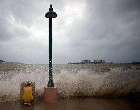
Hurricane Earl became the fifth named storm of the 2010 Atlantic hurricane season Sunday, sweeping into the Caribbean and north of Puerto Rico Monday.
Earl's eye - which contains the storm's most intense winds - will probably stay offshore as the storm roars past the Outer Banks Friday, said Jeff Masters, director of meteorology for the website Weather Underground.
A slight jog to the west could bring the eye ashore on the North Carolina coast late Thursday night or early Friday morning, but there's only about a 10 percent chance of that happening, Masters said.
Still, even if Hurricane Earl's eye stays offshore, North Carolina and the mid-Atlantic coast are likely to experience winds of at least 35 miles (56 kilometers) an hour as the storm passes northward.
Hurricane Earl to Stay Strong?
Hurricanes draw their strength from warm ocean water, and Hurricane Earl is expected to maintain its intensity thanks to unusually warm Atlantic waters, which are currently two to four degrees Fahrenheit (about one to two degrees Celsius) above normal, Masters said.
Although Earl could weaken some as it moves northward, the exceptionally warm waters are likely to keep the hurricane's strongest winds stoked to at least 111 miles (178 kilometers) an hour, making it a Category 3 hurricane well north of North Carolina, Masters said.
"You usually don't expect a Category 3 hurricane north of North Carolina," Masters said. "There's an excellent chance that Earl will be a Category 3 or maybe a Category 4 until it reaches New Jersey. That only happens once or twice a decade."
The last time a Category 3 storm made landfall in North Carolina was in 1996, when Hurricane Fran came ashore near Wilmington (map).
(Also see "Dramatic Increase in Hurricanes Likely Coming This Month.")
Earl could ultimately make landfall Saturday morning in Nova Scotia, Canada (map), as a Category 1 hurricane with winds of at least 75 miles (120 kilometers) an hour.
Meanwhile, an earlier storm, Hurricane Danielle, has dissipated harmlessly over open water in the North Atlantic. Tropical storm Fiona, which formed yesterday, is not expected to strengthen significantly, and that storm also remains well offshore of the U.S.


Reader Comments
to our Newsletter