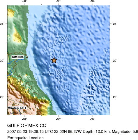
Wednesday, May 23, 2007 at 19:09:15 (UTC)
Wednesday, May 23, 2007 at 1:09:15 PM = local time at epicenter
Location 22.025°N, 96.267°W
Depth 10 km (6.2 miles) set by location program
Region GULF OF MEXICO
|
| ©USGS |
The Gulf of Mexico earthquake of May 23, 2007, occurred in the interior of the North America plate, approximately 700 km north of the boundary separating the North America plate from the Cocos plate and about 300 km from the nearest earthquake activity that is clearly related to the plate boundary. From a global perspective, the level of earthquake activity in the Gulf of Mexico basin is low, but the Gulf region has nonetheless experienced several dozen small and moderate earthquakes in the past three decades. The largest of these, the shock of September 10, 2006, had a magnitude of 5.9. The epicenter of the May 23 earthquake is more than 1000 km from the epicenter of the September 2006 earthquake. The two earthquakes both represent the release of stress within the North America plate, but they are otherwise unrelated and occurred on different faults.


Reader Comments
to our Newsletter