Extreme Temperatures
S


Sheeple

6,000 sheep trapped by early snow in French Alps - snowdrifts 2 meters deep

6.000 sheep and ewes, about a hundred cows, divided into five flocks are trapped in the snow
Thousands of sheep have been trapped in the Col du Gandon in the Savoie in the south-east France at 2,000m altitude after heavy snowfalls on Friday night took shepherds by surprise. Locals managed to get emergency food supplies to the flocks on Sunday.

The 6,000 sheep and some 100 cattle got stuck in the Col du Gandon mountain pass along with their shepherds on the night of Friday 25 September after an early flurry of snow coupled with icy winds created snowdrifts of up to two metres high.

On Sunday the local town hall in Saint-Colomban-des Villards set up a crisis centre and launched an operation to feed the animals.

Snowflake

Spring storm brings snow to New Zealand's beaches and travel chaos - 'significant weather event'

Heavy snow in Queenstown, New Zealand.
© James Allan/New Zealand HeraldHeavy snow in Queenstown, New Zealand.
Temperatures in parts of the country feel minus 20 as 'significant weather event' hits

A spring weather bomb has battered New Zealand, closing roads, dumping snow on beaches and causing dozens of flight cancellations.

The country's Met service described the storm as "the worst of the season" and said it was the result of a low-pressure system moving up the country from Antarctica. The system was "very unusual in how widespread the severe weather is" and was a significant weather event, a release from the service said.

The National Institute for Water and Atmospheric Research said parts of the South Island could feel as cold as -20C on Monday and Tuesday.


Snowflake Cold

Coldest Northern Hemisphere temperature, first recorded by UW in 1991, now officially confirmed

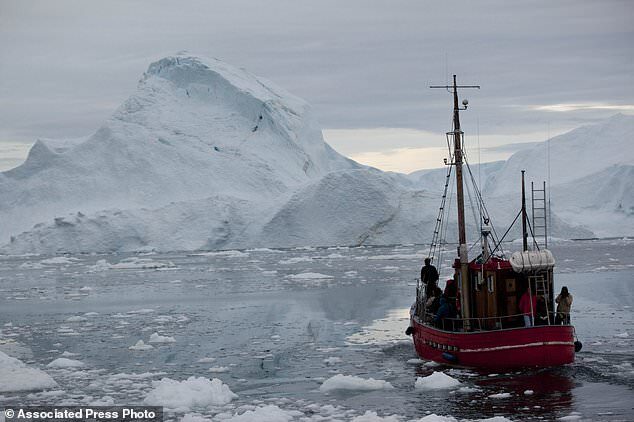
greenland icebergs
© Associated PressA boat steers slowly through floating ice, and around icebergs, all shed from the Greenland ice sheet, outside Ilulissat, Greenland
Experts have verified a 29-year-old weather reading from Greenland which sets a new record for the coldest temperature ever recorded in the Northern Hemisphere.

An automated weather station positioned more than 10,000 ft above sea level and atop the Greenland ice sheet took the measurement on 22 December 1991. The temperature sunk as low as -69.6°C (-93.3°F) at the site, located in a frigid place called Klinck, the World Meteorological Organization (WMO) says.

The temperature sunk as low as -69.6°C (-93.3°F) at an automated weather system, located in a frigid place called Klinck atop the Greenland ice sheet

Comment: More from EurekaAlert:
According to Weidner, this cold temperature was the result of several atmospheric conditions converging in a specific way.

The Klinck field site, where the coldest temperature was measured, is located in the middle of Greenland at an elevation of 10,170 feet (3,100 meters). Extreme cold air temperatures can occur when there is little wind to disturb an area, accompanied by clear skies.

In this case, the elevation and a splitting of the jet stream -- which usually flows over the Greenland ice sheet -- created a dead zone, allowing the already cold region to continue losing heat from the Earth. Similar conditions occur over Canada and result in the famed (or infamous) "polar vortex," which produces extreme cold that reaches the U.S.


Snowflake

Early snowfall in Czech Mountains

snow
© Horská služba Šumava – Kvilda
The current spell of cold brought on Saturday morning the season's first snow to the Czech mountains.

The first snow of this winter in the Czech Republic fell around the village of Kvilda in the Šumava mountain range in the southwest of the country on Friday night, Blesk.cz reported.

According to pictures from webcams, snowfalls were recorded as well at Bučina, Březník, Luzný and Klínovec in the Ore Mountains, the Czech Hydrometeorological Institute informed on Facebook.

Snowflake Cold

Scottish village recorded 'coldest September temperature for 20 years'

The weather station at Altnaharra
© Stuart Meek / Wikimedia / CC BY-SAThe weather station at Altnaharra.
A SUTHERLAND village is once again living up to it moniker as the coldest spot in the UK after the mercury plunged last night.

The temperature fell to roughly -5C in Altnaharra - making it one of the coldest September nights reported in Scotland for more than 20 years.

BBC weather presenter Matt Taylor, who is also a former senior operational meteorologist at the Met Office, confirmed the news on Twitter this morning.

Of course, -5C is nothing unusual in winter in Altnaharra, which holds the record for the coldest temperature ever documented in the UK. On December 30, 1995, the mercury plunged to an Arctic -27.2C (-17F).

Altnaharra wasn't the only slightly chilly place in the Sutherland last night. Kinbrace was not far behind Altnaharra's low, recording a temperature of close to -4.5C.

Weather stations at Klibreck and Banscol also recorded temperatures near to -3C.

Snowflake

Alps surprised by early snowfall, 2 Swiss towns set new records of 10 inches and nearly 2 feet

St Anton, Austria
St Anton, Austria
Parts of Switzerland, Austria and Germany were surprised by unseasonably early snowfall overnight, after a sharp drop in temperatures and heavy precipitation.

The Swiss meteorological agency said Saturday that the town of Montana, in the southern canton (state) of Valais, experienced 25 centimeters (almost 10 inches) of snowfall — a new record for this time of year.


Snowflake

Early snow in the northern hemisphere, late in the southern

La Rosiere in France
The forecast late-September snowfall in the Alps is underway, with resorts posting pictures and video of snow landing down to around 1500 metres altitude.

There's also fresh snowfall in the Dolomites, Pyrenees and up in Scandinavia as well as in Canada and in the southern hemisphere in Australia and New Zealand.

The snow in the Alps is being reported right across the mountains and is expected to continue through the weekend leaving some quite significant accumulations on higher slopes.


Comment: Away from the high ground in Australia snow has been falling in areas where it's not usually seen according to the following report from news.com.au:
Melbourne, Sydney weather: 'Polar plunge' brings snow across four states, cuts power to thousands

After delivering snow to places where it's never been seen before, the polar blast has hit Sydney with a severe weather warning in place.

Thousands were left without power in Sydney's east this afternoon after being lashed with strong winds, causing 130 electrical hazards as roofs were torn from homes and powerlines were dragged down.

Winds of more than 100km/h were recorded across the city as Bondi, Bondi Beach and North Bondi were left without electricty from 1.40pm, affecting 1700 residents.

Power has since been restored in these areas.

It comes as the city was hit by the "polar surge" that rocked Australia's south east today, bringing some of the coldest September temperatures for years and delivering snow to places that have never seen it before.

A severe weather warning is place for damaging winds of up to 90 km/h for the Illawarra and Southern Highlands to Sydney and the Central Coast.

"A strong cold front is bringing gusty winds to much of NSW today. Vigorous winds are expected to continue during Saturday in the front's wake," the Bureau of Meteorology (BOM) said.

Temperatures are also set to fall in Sydney and other parts of New South Wales as the system passes through.

Elsewhere, snow has fallen as low as just a few hundred meters above seal level as a "polar plunge" sweeps across south eastern Australia. It's so cold, people have been seen skiing 200kms north of Adelaide.

"We have snow here in western Victoria in places that never or rarely have snow," said one Victorian on Twitter.

Temperatures in Melbourne didn't get into double figures until 10.30am on Friday morning with the day set to top out a just 12C.

Parts of Victoria may experience a September day that hasn't been this chilly since the early 2000s.

The BOM has said Friday and Saturday temperatures will be so chilly it will feel more like mid-July than late-September.

A cold air mass brewed up from the Great Australian Bight on Thursday night and is now passing through Victoria and southern New South Wales.

Images have been posted online of snow falling close to Jamestown, Peterborough and Hallet in SA as well as on the lower slopes of Mt Elephant close to Lismore in Victoria, 170 km west of Melbourne. Lismore is only around 200 metres above sea level.

On Friday, the BOM labelled the weather event a "polar plunge" that could bring hail and thunder as seen as snow with maximums 5 - 10C below the average for this time of year.


Comment: Elsewhere in the southern hemisphere late substantial snow has also been predicted for South Africa this weekend reports The South African:
There's a cold front sweeping in from the west of the country, and as the temperatures plummet, some of the forecast rain is likely to bring brief snow flurries with it on Saturday. The weather is taking a turn for a miserable in both the Western Cape and Eastern Cape this weekend, and the next few days promise to be chilly.

SA WEATHER FORECAST FOR SATURDAY 26 SEPTEMBER

According to the latest forecasts from Ventusky - the weather mapping service that uses up-to-the-minute data - there will be a substantial amount of settling snow in regions that are well-known for their wintery aesthetics.

It is predicted that snow will make landfall on Saturday morning. Only the two aforementioned provinces will be hit by the icy change in weather, but given that the affected locations are high above sea level, a little blizzard or two isn't exactly out of the ordinary for them. This may be relatively late in the year for a snow forecast, but it's nothing a few extra blankets and a decent heater can't help with!


Ice Cube

Robert W Felix: 'Earth is about to enter a Mini Ice Age'

The Thames during the Great Frost of 1739
© City of London CorporationThe Thames during the Great Frost of 1739 by
Jan Griffier II
Robert W Felix, author of "Not by Fire but by Ice" and proprietor of iceagenow.info, has written a great article entitled "Earth about to enter Mini Ice Age" — below is my abridged version.

I've been saying this for years, begins Felix, but now we're starting to hear it from the mainstream media. As power-hungry politicians ramp up their man-made global warming propaganda, some scientists warn that a far different type of climate change is headed our way.

11 Scientific Predictions for the upcoming Grand Solar Minimum (spoiler: wrap up, its getting cold)

We should be bracing for a prolonged solar minimum that could last for decades, until the 2050s, is the stark advice coming from Valentina Zharkova, professor at Northumbria University in Newcastle, England.

"The Sun is approaching a hibernation period," says Zharkova, who holds a BSc/MSc in Applied Mathematics and Astronomy, and a Ph.D. in Astrophysics: "Less sunspots will be formed on the solar surface and thus less energy and radiation will be emitted towards the planets and the Earth."

Comment: See also:


Snowflake

Changbai Mountain in Jilin province, China gets early snow

snow
The snow fell on the main peak of Tianchi in Changbai Mountain on the night of 17th. At 8:00 on the 18th, the snow depth was 1cm. This is the first time that Changbai Mountain has put on silver clothing since autumn this year. At this time, the temperature in many parts of the country was around 20 degrees.


Snowflake Cold

Temperatures have been FALLING for the past 8,000 years

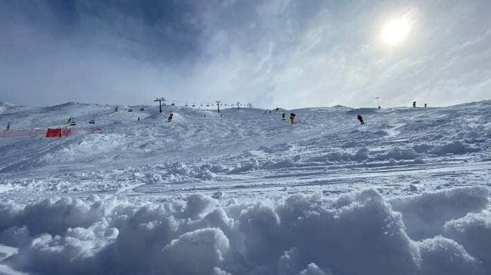
Coronet Peak is in the midst of a three-day spring snow storm with 15cm of fresh snow on Tuesday morning.
The 'hottest year ever' is a lie.

Short term variations, local record hots and colds, don't mean much, that's just weather. What matters is long term global trend lines over decades, centuries, millennia, eons, epochs.

Expanded record of temperature change since the end of the last glacial period

The only 'normal' in climate is constant change

Some places are hotter than average and some places are cooler than average on any particular day (I don't use 'normal' because the only 'normal' in climate is constant change).

Comment: To read more about the true drivers behind our planet's climate, see: Also check out SOTT radio's: