Earthquakes
S


Bizarro Earth

Tsunami warning lifted in El Salvador and Nicaragua after 7.0 magnitude earthquake strikes in Pacific Ocean

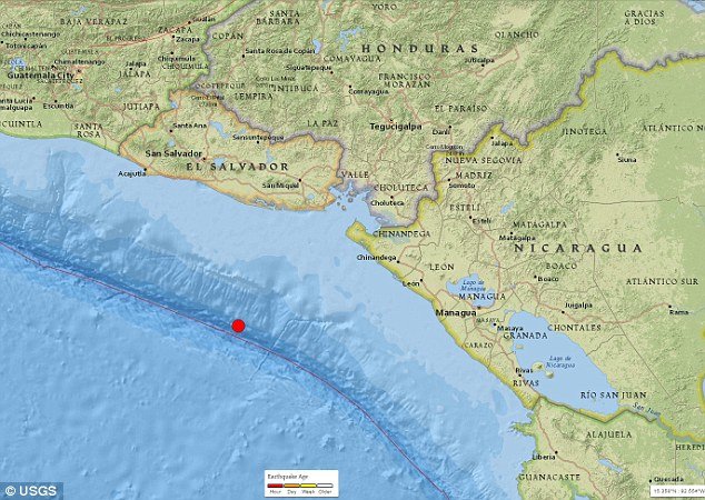
El Salvador earthquake map
© USGSThe 7.0 magnitude quake struck at a depth of 20 miles (33 kilometers), some 96 miles (154km) south-southwest of Puerto Triunfo in El Salvador

Earthquake hits, triggering tsunami warnings, after Nicaragua Caribbean coastline battered by hurricane


A 7.0 magnitude earthquake has shaken El Salvador and Nicaragua, just an hour after a powerful hurricane hit Nicaragua's eastern coast.

The double whammy was a grim test for a largely poor region which lacks resources and emergency plans for natural disasters.

Salvadoran authorities issued a tsunami alert as a precaution after the tremor, which struck around 75 miles off the coast of El Salvador, at a depth of 20 miles beneath the Pacific Ocean, according to the US Geological Survey. The quake was first measured at a magnitude of 7.2 but was then downgraded.

"Hazardous" waves measuring about up to 1m (three feet) were anticipated to hit coastal areas within 300km of the quake's epicentre. Officals warned anyone living on the Pacific coast of El Salvador to withdraw at least 1km away from the shore.

The tsunami warnings were lifted within hours of the earthquake on Thursday, according to the assistant director of the Sinapred national disaster prevention agency, Guillermo Gonzalez, said at a press conference.

Mr Gonzales said they would continue to monitor the threat from hurricane Otto, which continued to dump heavy rain and winds on Nicaragua.
Bizarro Earth

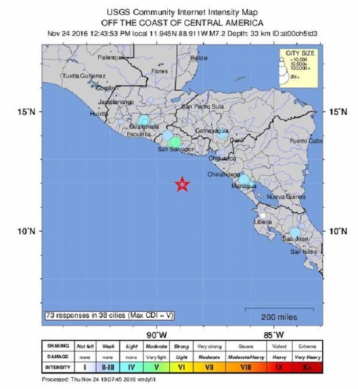
7.2 magnitude quake strikes off the coast of El Salvador - Tsunami alert issued

El Salvador Earthquake
© USGS
Details to follow. USGS report.

Arrow Up

6.1 magnitude earthquake hits near Fukushima, Japan - days after 7.4 quake struck the same area

6.1 Japan earthquake map
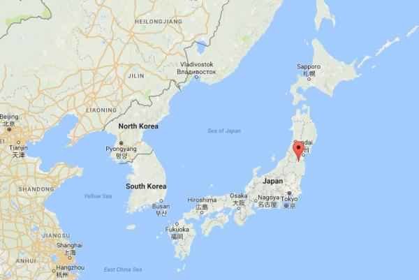
© Google Maps The second earthquake in three days to hit off the coast of Fukushima province in Japan, this one reported as a 6.1 magnitude by the Japan Meteorological Agency, hit around 6:23 a.m. Thursday morning. It was felt in Tokyo, like the previous one, however no tsunami warning was issued and there have been no reports of injuries or damage to property.
Japan has been struck by a 6.1-magnitude earthquake in same region a 7.4 magnitude quake rattle the country just three days ago.

The quake occurred about 6.30am (local time) on Thursday 37km south of Namie, according to the, according to the Japan Meteorological Agency.

Five smaller earthquakes measuring between 4.6 and 3.2 magnitudes followed in quick succession within and hour and a half.

A sixth stronger earthquake measuring 5.2 in magnitude struck just after 9.30 am (local time) in the Tori-shima Kinkai region, which is an uninhibited island located about 600km south of Tokyo.

There have been no reports of injury or damage and no tsunami warning has been issued, according to Nine News.

A 7.4 earthquake struck off the coast of Fukushima on Tuesday, triggering a one metre tsunami.

Bizarro Earth

Incredible drone footage captures giant cracks left by New Zealand earthquake (VIDEOS)

New Zealand earth cracks
© GNS Science / YouTube
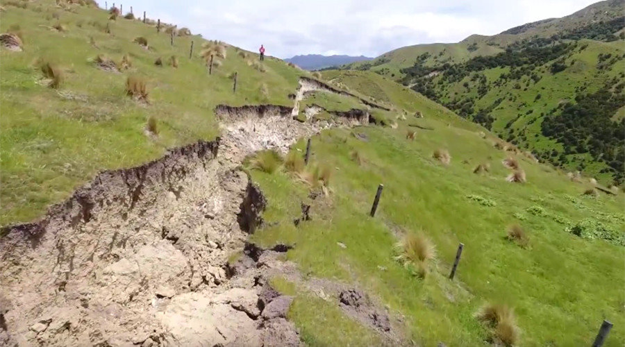
Following the 7.8-magnitude earthquake which struck New Zealand's South Island last week, scientists sent a drone to examine the damage left in its wake along the Kekerengu and Papatea fault line ruptures.

The footage shows the extent of the damage caused, and is a sobering watch in light of the latest earthquakes that struck the country Tuesday. The North Island was hit with a 6.0-magnitude earthquake. The South Island also experienced a 5.3 quake a few hours later that may have been an aftershock from the previous week.

The Kekerengu Fault is one of several to have ruptured during the Kaikoura earthquake on the South Island. Scientists estimate the surface rupture to be about 30km (19 miles) long.

The videos were created by GNS Science, a geoscience research company. They sent a drone over both the Kekerengu Fault and the Papatea Fault in the northeast South Island with captivating results, highlighting the damage sustained as well as New Zealand's beautiful landscapes.


Comment: See also:


Alarm Clock

Japan lifts tsunami advisories issued after 7.4 magnitude earthquake

Japan tsunami warning
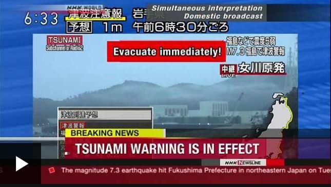
Japanese broadcaster NHK World reported that people should evacuate immediately
Japan has lifted the tsunami advisories issued after a 7.4 magnitude earthquake hit its eastern coast.

The quake struck near Fukushima at about 06:00 local time (21:00 GMT Monday), triggering initial warnings of 3m (9.8ft) high waves. The waves which eventually hit the coast were much smaller.

Thousands were asked to evacuate the area and minor injuries were reported.

An earthquake and tsunami struck the area in 2011 killing 18,000 people.

That quake, one of the most powerful ever recorded, also caused a meltdown at the Fukushima nuclear power plant, where a massive clean-up operation is still going on.

Officials have said there is no sign of damage to the plant this time.

The US Geological Survey initially put the magnitude at 7.3 but later downgraded this to 6.9, lower than the number given by the Japanese authorities.

The Japan Meteorological Agency (JMA) said in its latest update that no tsunami damage is expected, although there may be slight changes to the sea level.

Solar Flares

6.0 earthquake shakes New Zealand's North Island

New Zealand earthquake map
© USGS
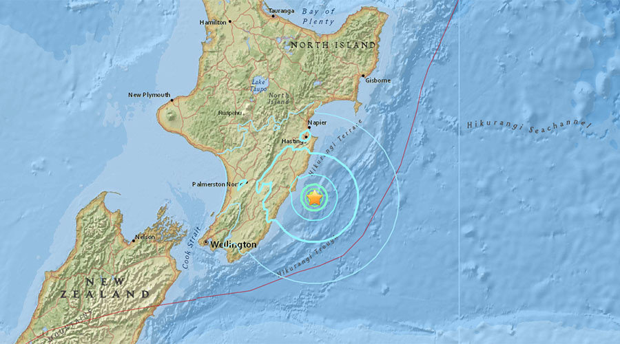
New Zealand has been hit by a 6.0 magnitude earthquake off North Island, USGS reports, just hours after Japan suffered a 7.4 magnitude jolt and a series of aftershocks off the Fukushima coast which unleashed tsunami waves.

The earthquake, initially estimated at magnitude 6.3, was registered at a depth of 37km (23 miles) and centered off the coast of North Island, some 123km (76 miles) from Palmerston North.

Bizarro Earth

7.3 Magnitude earthquake off Fukushima triggers tsunami warning

Japan Earthquake
© USGS
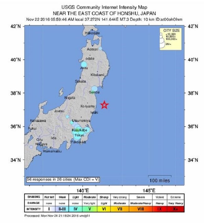
A powerful 7.3 magnitude earthquake has struck Fukushima Prefecture in Japan, USGS reported. A three meter tsunami wave alert was issued for Fukushima, Nippon reported.

The quake struck 67km northeast of Iwaki, a city located in the southern part of the Hamadori coastal region of Fukushima Prefecture, Japan.


Comment: Update: Fukushima reactor cooling system stops following quake & tsunami
The cooling system of the third reactor at the Fukushima nuclear power plant has stopped circulating water following a powerful 7.3 offshore earthquake. TEPCO said it managed to restart the system some 90 minutes after the failure.

The cooling system servicing the Unit 3 spent fuel pool was not able to circulate water to cool the nuclear fuel because of a broken pump, according to the Nuclear Regulatory Agency.

The temperature in the pool went up to 29 degrees Celsius. It takes up to seven days for temperatures to rise to 65 degrees Celsius, which is the upper operational limit, Japan's national nuclear agency said.

At such a pace, the cooling system failure posed no "immediate danger," although the agency admitted "gradual" rise in temperatures.

The exact cause of the cooling system stoppage is currently unknown. However, the system might have been "shaken" during the earthquake, according to nuclear agency officials, as reported by NHK. The station's storage pool currently contains 2,544 spent fuel rods. No cooling water leaks or any other "abnormalities" have been reported.

The first tsunami wave which hit the nuclear power plants was about one meter high, while the second was "not very high," according to TEPCO. There has been no "major physical damage" to the nuclear power plants, NHK reported.


Attention

New study finds that California's San Andreas Fault could actually rupture along its entire 800-mile length

San Andreas Fault
© Getty
A recent study found that California's San Andreas Fault could actually rupture along its entire 800-mile length. It was previously believed that "The Big One" could only occur in confined segments, and this new information is now being used by insurers to make some unnerving predictions.

For years, the scientific consensus was that a statewide earthquake couldn't occur in California. But a 2014 study by federal, state and academic researchers determined that a quake that begins at either end of the fault could zip up the line for hundreds of miles.

Morgan Page, a USGS research geophysicist who participated in the 2014 study tells the Wall Street Journal, "Scientists weren't really sure if you could have a rupture through the creeping section of the San Andreas. Now we think it's not very probable, but it is possible."

That means insurers have to figure out their potential payouts in the event that the worst case scenario comes true. CoreLogic Inc. is a real-estate analytics firm in Irvine, California, that has now crunched the numbers. It's safe to say that premiums could be rising. The Wall Street Journal summarizes some of the CoreLogic findings:
As many as 3.5 million homes could be damaged in an 8.3-magnitude quake along a roughly 500-mile portion of the fault—compared with 1.6 million homes damaged if only the northern part of the fault were to break, or 2.3 million if the southern piece ruptured.

The damage to homes alone could total $289 billion, compared with a previous range of $137 billion on the southern portion of the fault and $161 billion in the north, according to the CoreLogic analysis.
One of the best points of reference for an earthquake this size is the 9.0 earthquake that hit Tohoku, Japan in 2011. It's believed that an 8.0 or higher is likely to hit California every 2,500 years. Maiclaire Bolton, a seismologist and senior product manager for CoreLogic, emphasized, "We are talking about very rare earthquakes here."

Source: Wall Street Journal

Bizarro Earth

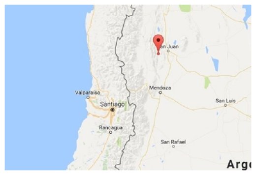
Strong 6.4 magnitude earthquake strikes Argentina

Argentina Quake
© Google Map
A strong earthquake (sismo) with a preliminary magnitude of 6.4 has struck near San Juan in western Argentina, with tremors being felt as far away as Chile's capital Santiago, seismologists and residents say.

The earthquake, which struck at 5:57 p.m. local time on Sunday, was centered about 75 kilometers west of San Juan, or 253 kilometers northeast of Santiago. It struck at a depth of about 115 kilometers, making it a deep earthquake.

Chile's seismological agency put the preliminary magnitude of the earthquake at 6.3, while the U.S. Geological Survey (USGS) put the magnitude at 6.4. Shaking was felt across parts of Argentina and Chile, including cities such as San Juan, Mendoza, San Rafael, San Felipe, and Santiago.

There was no immediate word about damage or casualties, but authorities say there is no threat of a tsunami because the earthquake was centered on land. We're working to gather additional information.

Cow

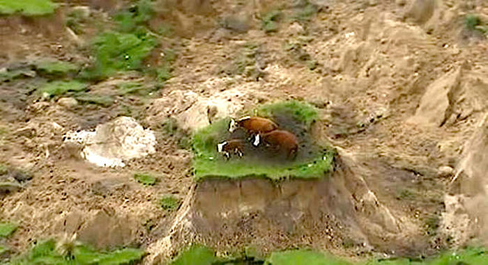
New Zealand earthquake left cows stranded on island of grass

stranded cows
© Live Sciencethree cows stranded on an island of grass in a paddock that had been ripped apart following an earthquake near Kaikoura, New Zealand Monday, Nov. 14, 2016.
Three New Zealand cows whose predicament captured the interest of many people around the world after they became stranded on a small island of grass following a powerful earthquake have been rescued.

The Newshub news service reported Tuesday that the two cows and a calf were rescued after a farmer and some helpers dug a track to them and brought them out.

Newshub first filmed the cows stuck on the patch of grass near the township of Kaikoura after the magnitude 7.8 quake triggered landslides around them.

The farmer, who was not named by Newshub, said the cows were desperate for water after they were rescued. He said the quake fault line ran right beneath his farm, which had been relatively flat before the earthquake.

New Zealand's 10 million cattle easily outnumber its 4.7 million people.