Earthquakes
S


Seismograph

Shallow 5.8 magnitude earthquake hits the Mariana Islands

Seismograph
© Flickr/ Matt Katzenberger

5.8 magnitude earthquake

2016-12-14 02:01:25 UTC

UTC time: Wednesday, December 14, 2016 02:01 AM

Your time: 2016-12-14T02:01:25Z

Magnitude Type: mwp

USGS page: M 5.8 - 95km NNW of Farallon de Pajaros, Northern Mariana Islands

USGS status: Reviewed by a seismologist

Reports from the public: 0 people

2016-12-14 02:01:25 UTC 5.8 magnitude, 38 km depth Mariana Islands

Seismograph

Shallow earthquake of magnitude 3.9 hits near Mammoth Lakes, California

Seismograph
© Flickr/ Matt Katzenberger
A shallow magnitude 3.9 earthquake was reported Tuesday evening two miles from Mammoth Lakes, Calif., according to the U.S. Geological Survey. The temblor occurred at 11:44 p.m. Pacific time at a depth of 3.7 miles.

According to the USGS, the epicenter was 70 miles from Clovis, Calif., 72 miles from Sanger, Calif. and 76 miles from Fresno, Calif.

In the past 10 days, there has been one earthquake of magnitude 3.0 or greater centered nearby.

This information comes from the USGS Earthquake Notification Service and this post was created by an algorithm written by the author.

Attention

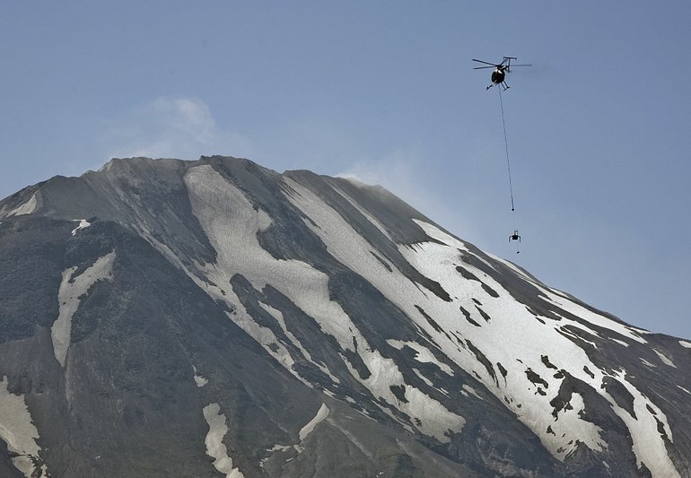
120 small earthquakes shake Mount St. Helens in a week

USGS scientists at Mt. St. Helens
© Columbian
Scientists call swarms of quakes evidence volcano is still active

In less than a week, four swarms of more than 120 earthquakes shook Mount St. Helens in late November. Although they were too small to be felt even by someone standing directly over their epicenters, scientists say they reveal the volcano is likely recharging.

"Each of these little earthquakes is a clue and a reminder we are marching toward an eruption someday," said Weston Thelen, a U.S. Geological Survey seismologist with the Cascades Volcano Observatory in Vancouver.

However, "there's nothing in this little modest seismicity, and none since 2008, that is a really good indicator of when that eruption will be."

The earthquakes occurred between 1 and 2 miles below the surface and most registered at magnitudes of 0.3 or less; the largest was a magnitude 0.5. While the quakes are too small for human perception, scientists are able to study them thanks to sensitive seismometers stationed around the mountain.

As magma comes into the volcano's system and is stored, scientists think that it releases gases and fluids that travel up into cracks, pressurizing and lubricating them, and causing small quakes.
Seismograph

Shallow 5.7-magnitude earthquake hits Central East Pacific Rise

The epicentre was determined with a depth of 10 km. (Representational Image)
An earthquake measuring 5.7 on the Richter scale jolted Central East Pacific Rise at 14:33:12 GMT on Sunday, the US Geological Survey said.

The epicentre, with a depth of 10 km, was initially determined to be at 9.1306 degrees south latitude and 109.846 degrees west longitude.

Source: Indo-Asian News Service

Seismograph

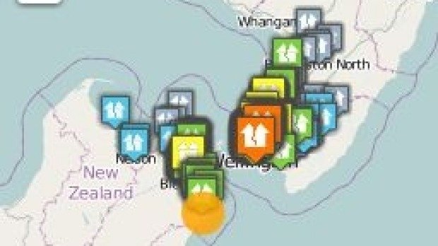
Two earthquakes in two minutes, one of them strong, shake central New Zealand

New Zealand quakes
© GEONETThe upper South Island and lower North Island, particularly the capital Wellington, was where the 4.7 magnitude quake felt the strongest.
Two earthquakes in two minutes, one of them a "strong" 4.7, have shaken central New Zealand on Monday evening.

GeoNet reported a preliminary magnitude 4.1 quake at 6.13pm, 10 km north of Culverden at a depth of 20km.

The second quake, a stronger magnitude 4.7, struck at 6.14pm, 15 km south-east of Seddon at a depth of 15km, GeoNet said.

Initially GeoNet classified the magnitude of the second quake as a 5.0 but this was later downgraded to a smaller, shallower 4.7.

By 6.45pm, more than 3000 people, mostly in the lower North Island and upper South Island, had reported feeling one or both of the quakes.

Seismograph

Enormous earthquakes occur on both sides of the Pacific: Experts warn that San Andreas could "unzip all at once"

ring of fire

Why is our planet shaking so violently all of a sudden? There have literally been dozens of significant earthquakes right along the Ring of Fire within the past 30 days, and two giant ones made headlines all over the globe on Thursday. First, a magnitude 6.5 earthquake struck off the coast of Humboldt County, California, and that was followed later in the day by a magnitude 7.8 earthquake in the Solomon Islands. But of course these latest earthquakes are just the latest examples of increased shaking along the outer perimeter of the Pacific Ocean. Experts are not quite sure what to make of all of this shaking, but they are warning that "the Big One" could strike the west coast at literally any time.

Let's start by discussing the historic earthquake that just hit the Solomon Islands. According to the Washington Post, it was originally determined to be a magnitude 8.0 earthquake before being downgraded to a 7.8...
A massive earthquake erupted along a fault line near the Solomon Islands in the southwest Pacific Ocean on Thursday. The quake was originally detected as a magnitude-8 by the U.S. Geological Service, but has since been reduced to a 7.8 on the Moment-Magnitude scale.

It was followed by a 5.5-magnitude quake, and aftershocks continue to roll through.

Seismograph

6.9 magnitude earthquake strikes off Solomon Islands

Seismograph
© Flickr/ Matt Katzenberger
An earthquake of magnitude 6.9 struck early on Saturday off the Solomon Islands, the U.S. Geological Survey said.

The quake had a depth of 10 km (6 miles) and its epicenter was 89 km west of Kira Kira. There was no immediate tsunami threat, the Pacific Tsunami Warning Center said.

A 7.8 quake hit the remote South Pacific islands early on Friday, sending residents into the hills and triggering powerful aftershocks.

Comment: See also: Emergency tsunami warnings after 8.0 quake strikes off Solomon Islands' coast


Attention

Emergency tsunami warnings after 8.0 quake strikes off Solomon Islands' coast

Solomon Island earthquake map
© USGS
A tsunami warning has been issued for the Solomon Islands, Vanuatu, Papua New Guinea, and Nauru after an 8.0. magnitude earthquake struck 70km off the Solomon Islands, according to USGS.

"Widespread hazardous tsunami waves are possible," stated the warning issued by the Pacific Tsunami Warning Center. The center called on the government agencies responsible for dealing with emergency situations to "take action to inform and instruct any coastal populations at risk in accordance with their own evaluation."

Bizarro Earth

6.5 magnitude earthquake off Northern California coast

California coast earthquake map
© USGS
The US Geological Survey has reported an earthquake with a magnitude of 6.5 in the Pacific Ocean off the coast of Northern California, with an epicenter 102 miles west of Ferndale.

Seismographs registered the quake at 6:49am local time (2:49 GMT), at the coordinates 40.507° North and 126.118° West, ten kilometers (6.2 miles) below sea level.

Reuters initially reported the quake was 6.8 in magnitude, in line with the National Weather Service reports for the same incident.

No tsunami warning was issued.

Seismograph

Precursor to eruption? Dozens of earthquakes rattle a Chilean volcano, alert status raised

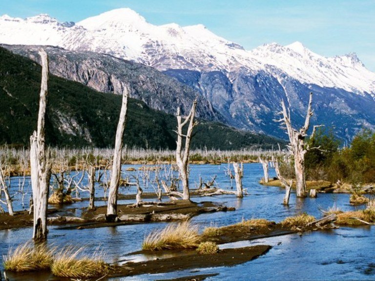
Cerro Hudson eruption in Chile
© John Warburton-Lee/Getty ImagesDead trees in the River Ibanez valley killed by ash from the Cerro Hudson eruption in 2011.
Last night, the ONEMI (Oficina Nacional de Emergencias) and SERNGEOMIN (Chilean Geological Survey) in Chile raised the alert status for the area around Cerro Hudson in the southern Andes.

Normally, raising the alert status like this is due to an acute change, when the behavior of the volcano shifts suddenly. However, this time, the elevation to Yellow alert status at Cerro Hudson is due to accumulated events over the past month.

Dozens of small earthquakes have occurred since the start of November, none stronger than M3.2. But their location (in geographic space and depth) are similar to those before the last eruption of Hudson in 2011. The number of earthquakes hasn't increased much above the baseline activity at an active volcano like Hudson, but energy released by the largest earthquakes has been increasing over the past few months.

Combine that with the fact that the earthquakes have the character of those associated with magma movement, and the SERNAGEOMIN and ONEMI decided to treat Hudson with an abundance of caution, setting up a 3.5 kilometer exclusion zone around the volcano.