Earth ChangesS


Tornado2

Rare winter tornadoes touch down in East Texas, surprising residents and damaging 50 homes

texas tornado damage
© KETKThere are reports of at least 50 homes damaged in Lindale, Texas, including the one pictured here. Residents in the area said that there were no storm warnings and alerts were not sent out

Rare December tornadoes surprised East Texas on Saturday afternoon, damaging 50 homes, destroying a bridge and injuring two people.

At least one tornado, probably two, touched down around 4pm in Lindale, about 90 miles southeast of Dallas, according to KETK.

The mayor has issued a declaration of disaster for the city.

'We saw these clouds and these little tornadoes that were shooting down and then one hit the ground. We saw it hit the ground, witness Melissa Malone told the outlet. 'From there we called 911 and immediately alerted them and the sirens started going off.'

Eyewitness Autum Green spotted the twisters forming on Iron Mountain Road in Lindale and captured them with her cell phone.

'It was kind of cool watching it build up, but I was really scared,' Green said, adding that she normally gets weather alerts, but none came with the tornado.

'On the movie Twister where they had the two tunnels come through, they twirled around each other, that's what it looked like,' she said.

The National Weather Service did not send out warnings and people in Lindale were caught completely unawares, reports the outlet.
Comment: Another 'rare' winter tornado in the United States, just a few days after another one battered homes in Battle Ground, Washington. Last month another 'rare' tornado hit a Californian town, a massive mile wide tornado reportedly leveled a Halliburton plant and a tornado outbreak of more than 20 touched down across western Kansas, which was called "unprecedented" by a weather official.

Meanwhile other 'rare' tornadoes continue to strike all over the planet this year, including Northern Ireland, England, Australia, Hawaii and India.


Attention

Massive sinkholes, landslides endanger northwestern Oregon neighborhood

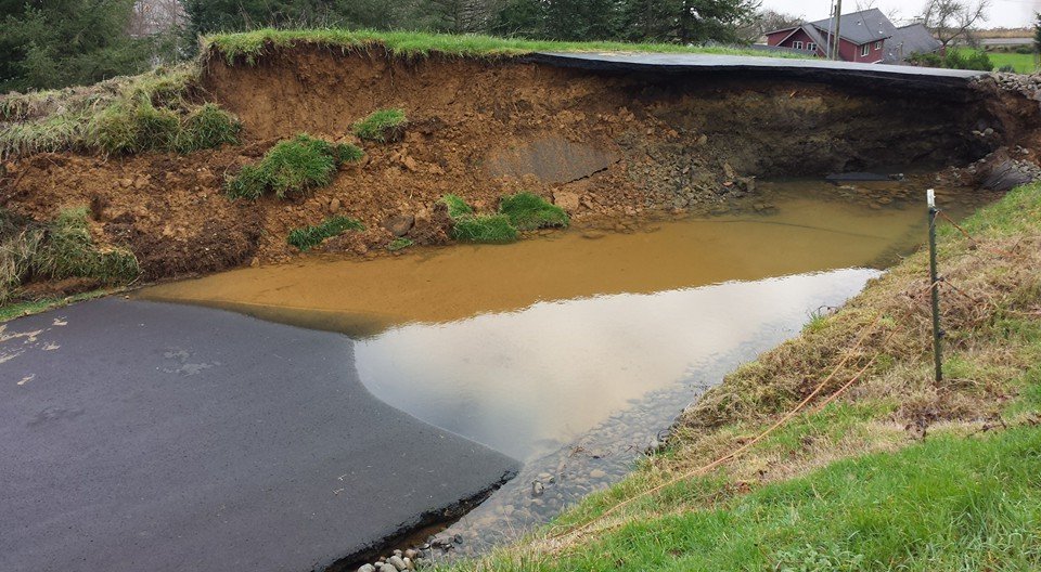
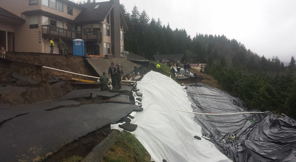
Seven families in a cluster of hillside homes above the Tillamook River spent the past week watching the two roads they live on slip, buckle and tangle into a slide of rocks, mud and trees.

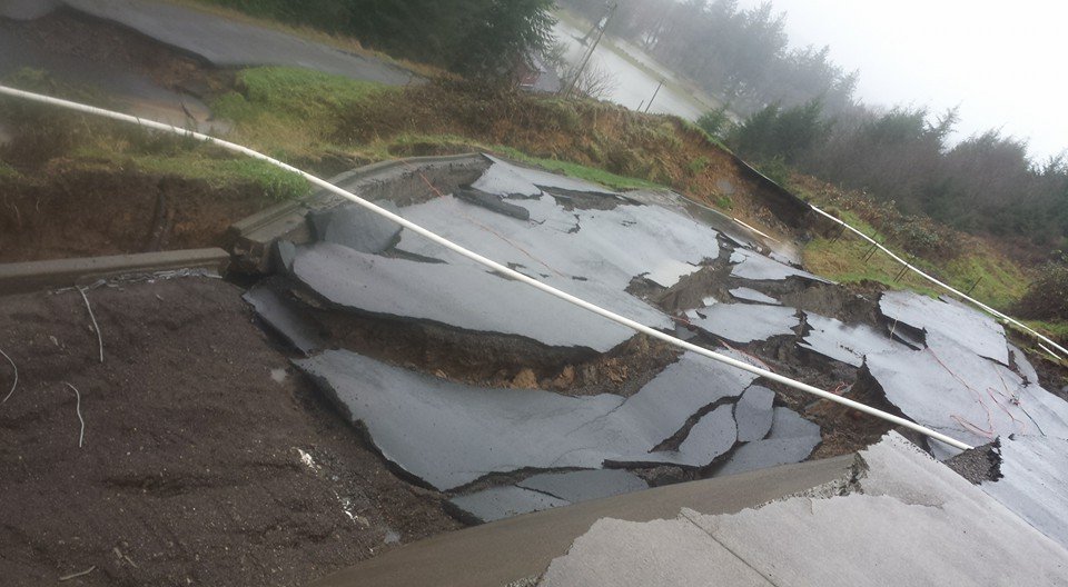
It began Monday as a few little cracks on Burton Hill Road, just outside Tillamook. By Wednesday the cracks had collapsed into a quarter-mile series of sinkholes and creeping mud that put three homes at risk, pushed a barn off its foundation and left homeowners fearful of what will move next.

As the rains continue, they say only one thing is clear: No one is coming to the rescue.
Oregon neighborhood
© The Oregonian
Oregon neighborhood
© Oregonian
Morgan Kottre, 27, said she and her neighbors - some of them relatives - have been told by county, state and federal officials that they don't qualify for assistance because Burton Hill Road and the lower Hillside Drive are private roads on private land. Same story from at least one insurance company. Kottre said a representative told one family the devastation qualifies as an "act of god," which the insurer doesn't cover.

"In theory, we could try to fight it," she said, "but right now we're just trying to fight the land." Storms over the past week that have brought flooding and landslides across northwestern Oregon. On Saturday afternoon, blizzard conditions closed three highways in Southern Oregon. The extreme weather has caused at least two deaths in Oregon and federal officials set early damage estimates at about $15 million.

Tillamook County was among the 13 counties where Oregon Gov. Kate Brown declared a state of emergency. In fact, not far from Kottre's home on Saturday night, the town of Oceanside was cut off as the only road out of town was closed due to a failed culvert.
Oregon road
© Oregonian

Comment: At the end of October this year, there was a massive swarm of earthquakes about 250 miles away from Tillamook County: Swarm of 29 earthquakes in 24 hours near central Oregon volcanic complex


Attention

Dead Minke whale found near Dutch island

Dead minke whale
© Hans Eelman/EcomareDead minke whale found near Den Helder, Dec 13th 2015
A nine-metre long whale has washed up on a sandbank in the Wadden Sea, close to the holiday island of Texel.

The whale, thought to be a female Minke, has been dead for some time, experts at the Ecomare wildlife centre said. She probably washed up on the sandbank known as the Razende Bol where the water is shallow.

Researchers from Utrecht University will try to establish the cause of death and what the animal had been eating. Minke whales are one of the smallest species of balleen whale and common in the North Sea. They are a primary target for the whaling industry.

In December 2012 a humpback whale died after becoming stranded on the same sandbank.

Attention

2015 has been the worst wildfire season in U.S. history

fire wildfire
© Unknown
The nation is closing in on its worst wildfire season in recorded history, with nearly 9.8 million acres already burned -- the equivalent of Massachusetts, Connecticut, Rhode Island and part of New Hampshire going up in flames.

Two large fires and more than 160 smaller ones remain active, and more fires are expected to be reported before the month ends. Together, they're likely to push the 2015 total past the record 9.87 million acres burned in 2006.

The extent of scorched earth reflects a warming trend that has made the United States considerably drier, scientists and fire expects say, with less mountain snowpack particularly in Alaska and the southwest.

Comment: It looks like the US is going up in flames.

See also: SOTT Earth Changes Summary - November 2015: Extreme Weather, Planetary Upheaval, Meteor Fireballs


Tornado1

Over 700,000 flee as powerful typhoon Melor slams Philippines

Typhoon Melor
© JAY DIRECTO / AFP - Getty ImagesMeteorologists from the Philippine Atmospheric Geophysical and Astronomical Services Administration monitor and plot the direction of Typhoon Melor in suburban Manila on Monday
More than 700,000 people in the central Philippines fled to safer areas for fear of giant waves, floods or landslides as Typhoon Melor slammed into the archipelago nation Monday, officials said.

Melor brushed the northern tip of Samar, a farming island of 1.5 million people, early Monday with winds gusting up to 185 kilometres (115 miles) per hour, the state weather bureau said. There were no immediate reports of casualties or damage.

Samar was among areas devastated in 2013 by Typhoon Haiyan, when giant waves wiped out entire communities and left 7,350 people dead or missing.

Authorities warned that Melor's powerful winds might whip up four-metre-high (13-feet) waves, blow off tin roofs and uproot trees. They said heavy rain within its 300-kilometre diameter could trigger floods and landslides.

In Albay province in the southeast of Luzon island, almost 600,000 people were evacuated due to fears that heavy rain could cause mudslides on the slopes of nearby Mayon Volcano, according to the national disaster monitoring office.

Residents carrying bags of clothes and water jugs clambered onto army trucks in Albay's Legazpi City as authorities sounded an evacuation alarm, according to an AFP photographer at the scene.

Comment: A couple of months ago Typhoon Koppu brought massive flooding to the Philippines


Attention

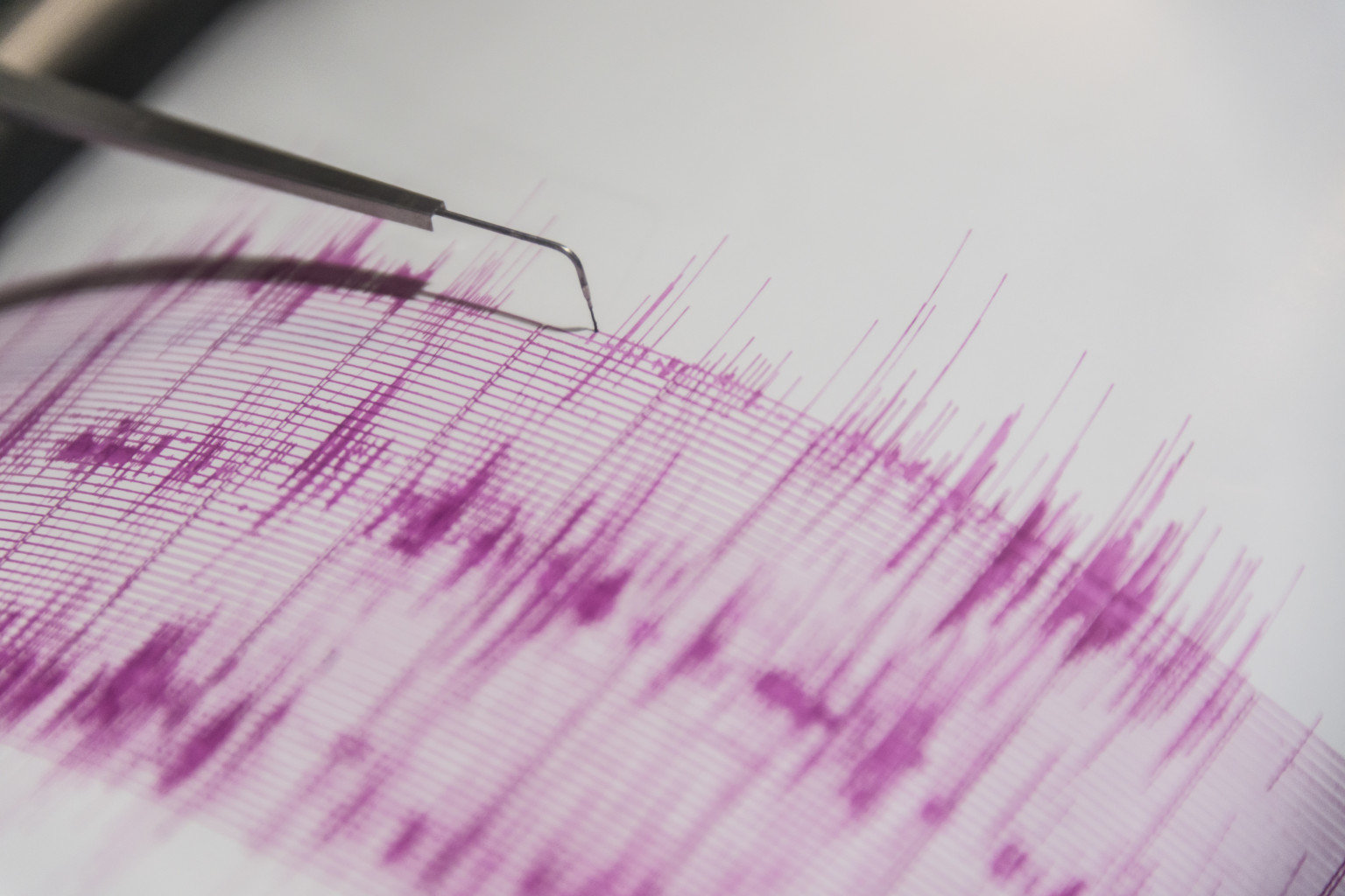
Seismic activity increases in Azerbaijan: 7,000 earthquakes in 2015

earthquake needle
Seismic activity intensified in Azerbaijan as the country faced about 7,000 earthquakes in 2015.

Magnitude of more than 80 earthquakes ranged from 3.1 to 5.9, and tremors of 17 were felt
, the Republican Seismological Service Center reported.

Azerbaijan locates in seismically active zone. Scientists believe that seismic zones with the potential to produce dangerous force cover the entire country, while the Alpine-Himalayan seismic belt passes directly through Azerbaijan.

An increase in seismic activity is observed since the beginning of the year in the northern part of Azerbaijan - in Oghuz, Shamakhi-Ismayilli, Shabran seismic zones, as well as in the southern part - the Talysh seismic zone, according to the center.

Cloud Precipitation

Communities on high flood alert along River Shannon, Ireland

Floods Ireland
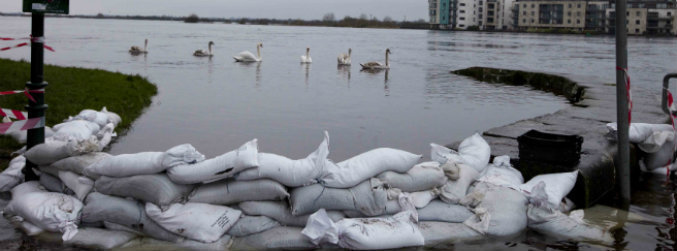
© RollingNews.ieSwans glide by a sandbag barrier on The Strand in Athlone Town, in the ongoing battle against the rising waters of the Shannon River.
The ESB will not increase the amount of water flowing through the Parteen Weir today.

It says the level of water in Lough Derg increased marginally in the past 24 hours and is warning that flooding is likely in communities along the River Shannon.

Residents in parts of Athlone say Christmas is on hold as they try to keep rising waters from flooding their homes.

It is raining heavily in the town this morning, and it is thought 100 houses are at risk.

Keith Walsh is one of a dedicated team of volunteers manning pumps around the clock.

He says houses in The Park area would be flooded were it not for a team effort.


Bizarro Earth

Looming threat of volcano disasters in Auckland

Auckland Volcanoes
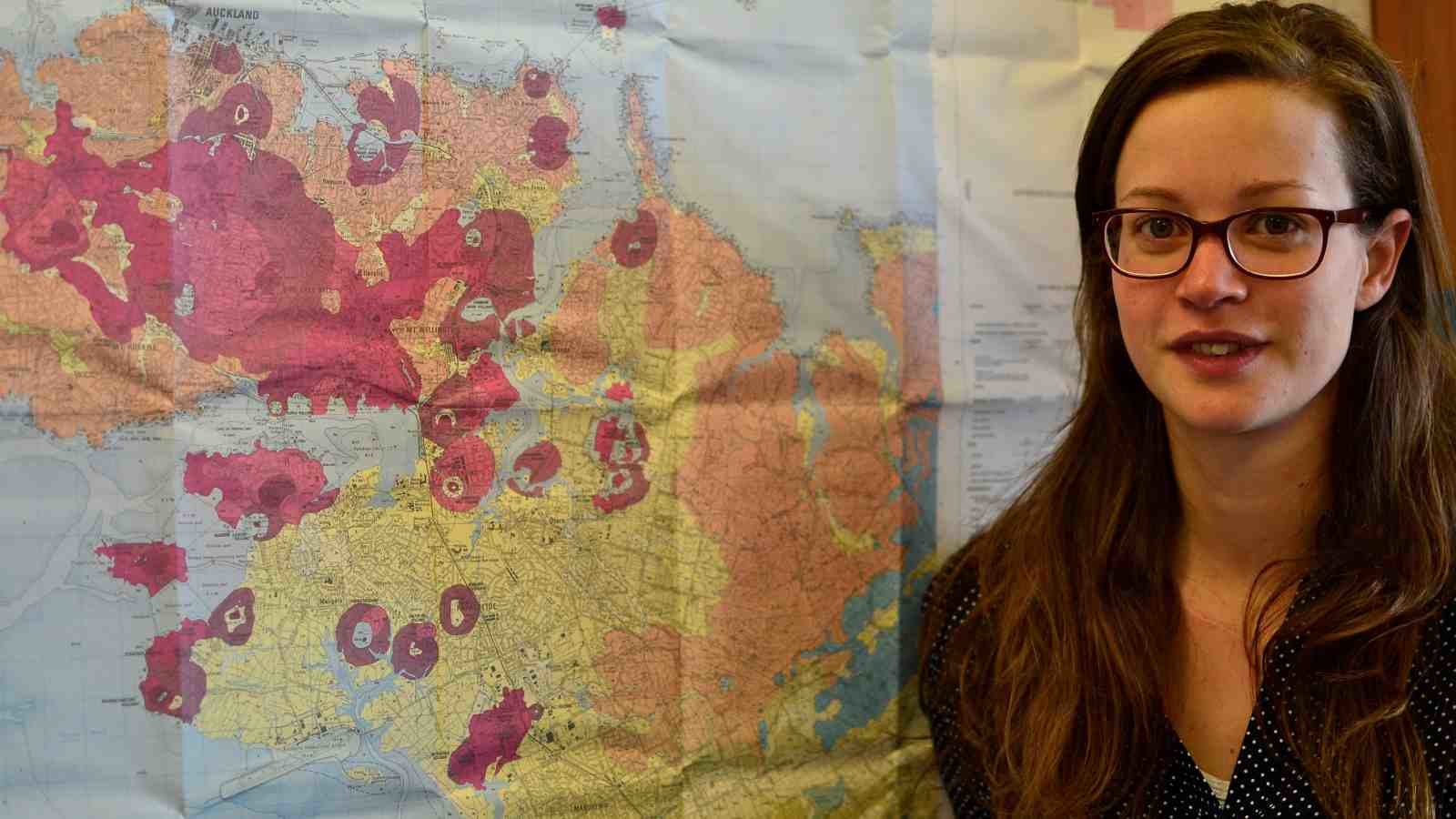
© Victoria University of WellingtonJenni Hopkins with a map showing Auckland's volcanic field.
Rangitoto, Mt Albert, Lake Pupuke, Orakei Basin, Mt Eden and One Tree Hill are some of Auckland's most familiar landmarks. But they are also reminders of the city's fiery history and the looming threat of future disasters.

A clearer understanding of the risk posed by a new volcanic eruption in Auckland has emerged from doctoral research undertaken by a student at Victoria University of Wellington.

Jenni Hopkins, in collaboration with GNS Science and the University of Auckland, has reconstructed the eruptive history of Auckland's volcanic field, which comprises more than 50 craters dating back around 200,000 years. While currently dormant, the field is expected to erupt again from a new site within potentially as little as a few hundred years.

"The 53 volcanoes in Auckland are almost entirely monogenetic, which means they generally only erupt once," says Jenni. "But what was previously unknown was the order in which they erupted—I wanted to find that out so that we could establish the characteristics of the field and get an idea of what a future eruption might be like."

Windsock

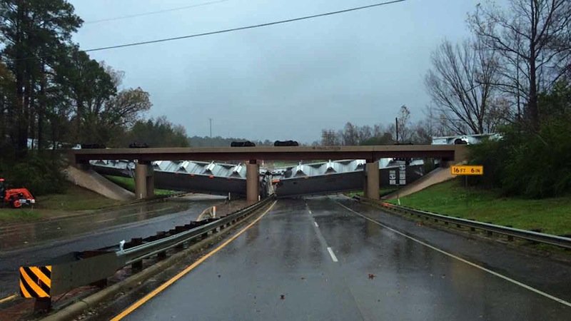
Strong winds blow train off tracks in Texas

Wind blows train off tracks
© Lufkin Police Dept
The Lufkin, Texas Police Department shared a photo on its Facebook page Sunday morning after winds blew a train off the tracks as it crossed a highway. An update says it will take at least 48 hours to upright the 64 rail cars.

Police advised drivers to avoid Loop 287 near 103 West and 69 North "as straight-line winds blew a train off the tracks."

The highway is shut down. The cars were believed to be empty when a gust of wind took them off the tracks around 7 a.m.
Wind blows train
© Lufkin Police Dept

Cloud Lightning

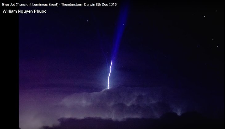
Large upper atomspheric lightning caught on camera in Darwin, Australia

Blue Jet (Transient Luminous Event)
© William Nguyen Phuoc Blue Jet (Transient Luminous Event)
Details:

This photo was taken by William Nguyen Phuoc in Darwin, Australia on Dec. 8 2015. This looks more like a Gigantic Jet than a Blue Jet but either way it is an amazing event.

A timelapse video of this event shows all the lightning activity before and after the event. You can view it here: