Earth ChangesS


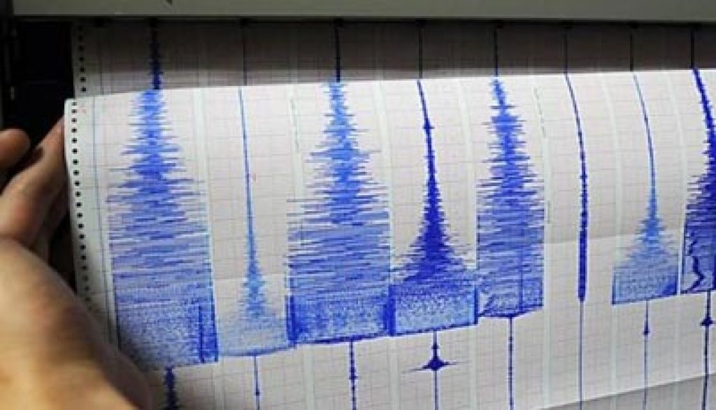
Seismograph

Powerful shallow earthquake of magnitude 6.6 hits off Papua New Guinea

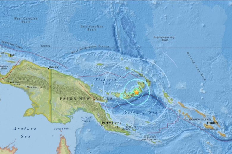
The earthquake struck 180 km west of the town of Rabaul, on New Britain island, at a shallow depth of 10 km, the USGS said.
© USGSThe earthquake struck 180 km west of the town of Rabaul, on New Britain island, at a shallow depth of 10 km, the USGS said.
A shallow 6.6 magnitude earthquake struck off Papua New Guinea on Monday (March 26), the US Geological Survey said, the latest in a series to hit the region in recent days, but there were no immediate reports of casualties or damage.

The quake struck 180km west of the town of Rabaul, on New Britain island, at a depth of 10 km, the USGS said. The quake was initially recorded with a magnitude of 7.0 but was later downgraded. There was no immediate tsunami warning.

"We are okay. No one is injured," said Sylvia Ombul, night desk supervisor at the Kimbe Bay Hotel in the port town of Kimbe, about 140 km to the west of the quake.

Comment: Just 2 days ago: 6.3-magnitude earthquake strikes Papua New Guinea region


Seismograph

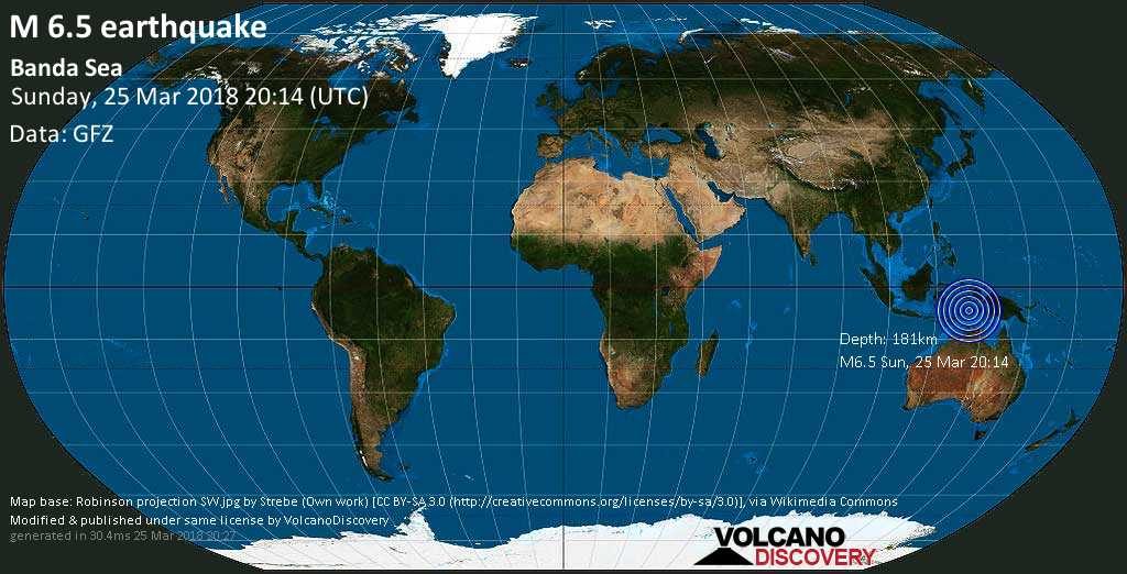
Powerful 6.5 earthquake in the Banda Sea

LOCATION
Date & time: Sun, 25 Mar 20:14:48 UTC

Magnitude: 6.5

Depth: 181.0 km

Epicenter latitude / longitude: 6.7°S / 129.72°E [Map]

Nearest volcano: Nila (31 km)

Primary data source: GFZ

Attention

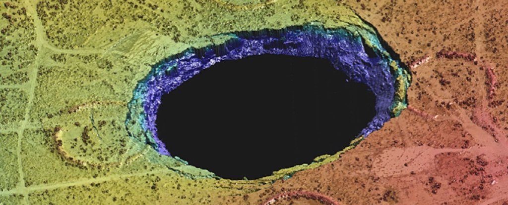
The heaving and sinking oil wells of Wink, Texas

Wink sinkhole
© J. AndrewsWink Sink 2
It began with sinkholes. Two of them, gaping mouths to nowhere opening up as if to swallow the town of Wink, Texas. As they expanded, there were fears they might collide, morphing into one giant void.

They first emerged in 1980, and things haven't gotten better since. Now, an unprecedented study reveals Wink and its vast sinkholes are just a tiny part of a much bigger problem - a vast stretch of historical oil fields that are heaving and sinking, covering an area almost the size of Connecticut.

"The ground movement we're seeing is not normal," explains geophysicist Zhong Lu from Southern Methodist University in Dallas.

"The ground doesn't typically do this without some cause."

Lu was part of a team who in 2016 used satellite data to reveal that the two Wink sinkholes weren't frozen in place, but could be about to expand in response to subsidence detected in and around the town.
Cloud Precipitation

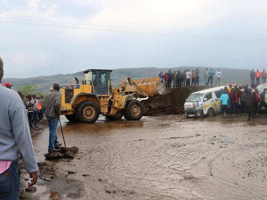
Tractors stuck in mud, planting delayed and crops rot due to heavy rains in most parts of Narok, Kenya

Passengers got stuck at Suswa-Narok Road on friday 9 March 2018 following heavy downpour that paralyzed the movement for more than an hour.
© COLLINS K.LANGATPassengers got stuck at Suswa-Narok Road on friday 9 March 2018 following heavy downpour that paralyzed the movement for more than an hour.
Heavy rains have disrupted planting in most parts of Narok county.

This is because mechanised farming has been rendered impossible.

Kenya National Chamber of Commerce and Industry Narok branch chairman David Mpatiany said the delay in planting may hurt crop production.

"We are happy the rains have come but it is unfortunate that most of the farmers, especially those who practice large-scale farming, can do little in their farms due to the soggy soil," he said.

Mpatiany said farmers will have to wait for the rains to subside so they can plant wheat, maize, barley, beans and sorghum.

Attention

Spring planting in Russia is delayed by weather conditions and snow cover

ploughing
According to the Ag Ministry, 1.9 Ml ha of Russian winter cereals (11.3% out of a total 17.1 Ml) were fertilized by March 16, 2018 against 4.7 Ml ha in 2017, reports UkrAgroConsult.

By the same date, spring planting was completed on 32.3 Th ha (0.1% of the projected area of 53.37 Ml ha). This included 9.4 Th ha in Krasnodar region, 1 Th ha in Chechnya and 0.2 Th ha in Adygea. 456.4 Th ha was already seeded to spring crops by the same date last year.

The start of planting is delayed in some regions of the Southern and North-Caucasian federal districts due to weather conditions and snow cover in single areas.

Snowflake

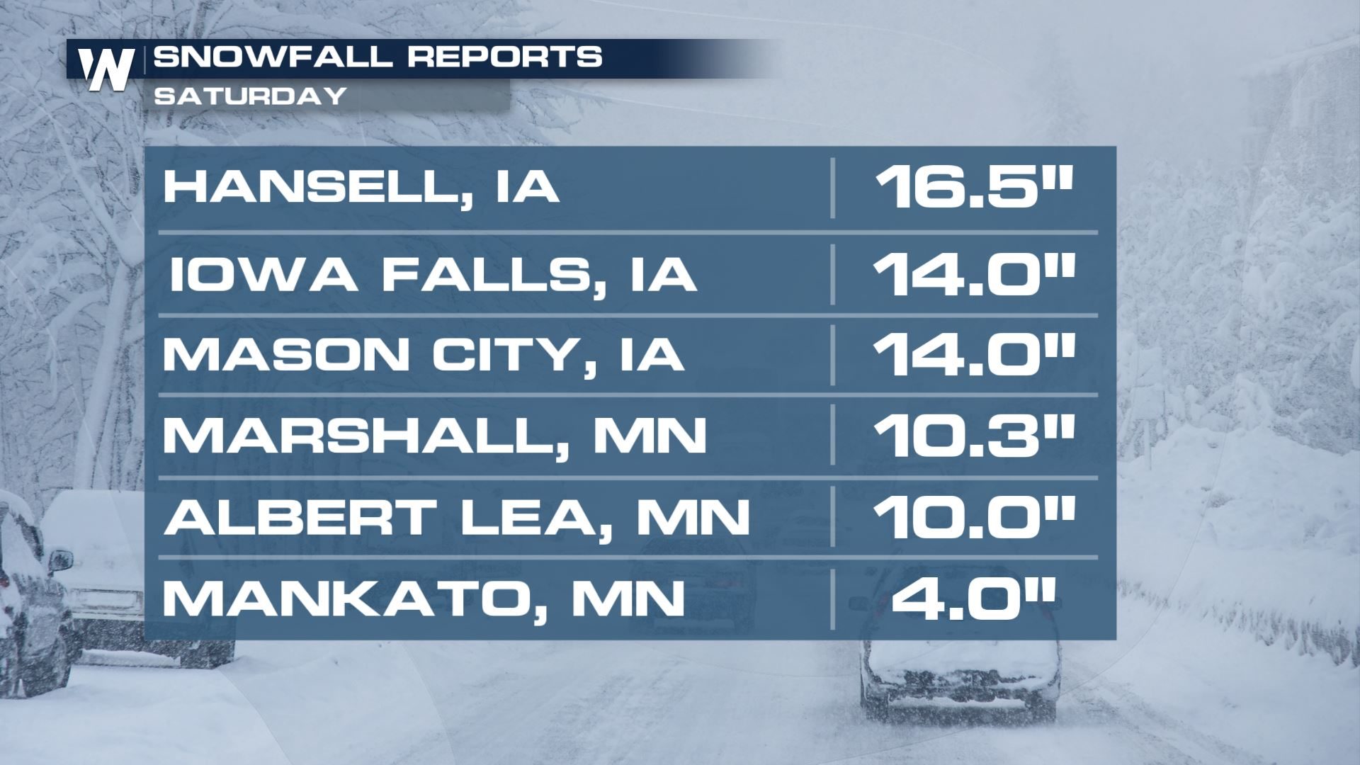
Heavy snow covers North Dakota to North Carolina with record late March snowfall for many cities

chart
People will be digging out Sunday morning in parts of the central U.S. and mid-Atlantic after more than a foot of snow fell in some areas! Take a look at the area-by-area snow totals from Saturday evening.

Multiple cities saw record snowfall Friday into Saturday for late-March. The snow caused some damage to trees due to the weight, caused near whiteout conditions, and made for difficult travel for people trying to get around during their weekend.

Seismograph

Shallow 6.3-magnitude quake strikes Southeast Indian Ridge

graph
An earthquake measuring 6.3 on the Richter scale jolted Southeast Indian Ridge at 19:58:33 GMT on Saturday, the U.S. Geological Survey said.

The epicenter, with a depth of 10.0 km, was initially determined to be at 45.8299 degrees south latitude and 96.099 degrees east longitude.

Attention

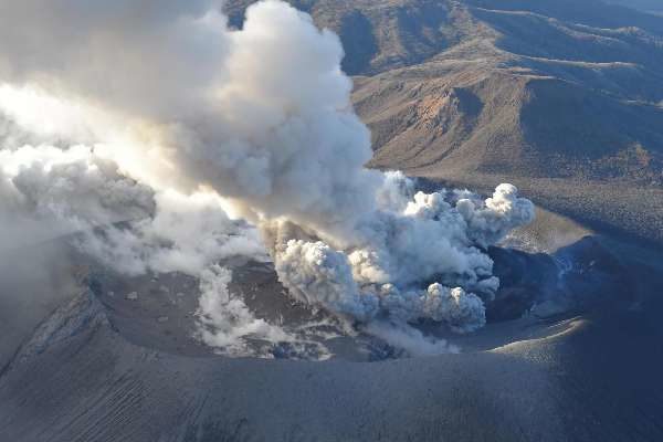
First pyroclastic flow recorded from Shinmoedake volcano eruption in Japan

Kyushu's Mount Shinmoedake
The first pyroclastic flow was recorded on March 25 from an explosive eruption on Kyushu's Mount Shinmoedake, which started erupting at the beginning of the month.

The Japan Meteorological Agency announced that a pyroclastic flow was confirmed over a distance of about 800 meters west of the crater, but it did not approach any residential area.

Eruptions began on March 1 with intermittent explosions from the crater, but this was the first recorded pyroclastic flow.

According to the JMA, explosive eruptions were recorded at 7:35 a.m. and 8:45 a.m. on March 25, and smoke and fumes rose to 3,200 meters. The pyroclastic flow was confirmed following the second explosive eruption.


Attention

Dead pilot whale could be species not typically found in Nova Scotia waters

The Marine Animal Response Team says it's believed a pilot whale that washed ashore in Nova Scotia could be a species that's rarely seen in northern waters. se Team
© Marine Animal Response TeamThe Marine Animal Response Team says it's believed a pilot whale that washed ashore in Nova Scotia could be a species that's rarely seen in northern waters.
A pilot whale that washed ashore in Nova Scotia could be a species that's rarely seen in northern waters, the Marine Animal Response Team said Saturday.

Andrew Reid, the team's response co-ordinator, said the 2.7-metre juvenile whale washed ashore outside of Dartmouth, N.S., on the province's eastern shore earlier this month.

Reid said after examining the whale, it was determined that it could be a short-finned pilot whale.

Long-finned pilot whales are common off the coast of Nova Scotia, but short-finned pilot whales tend to favour warmer waters.

"They are more of a southern species," said Reid. "They definitely don't tend to range as far north as Nova Scotia, that we're aware of."

Comment: If it is a short-finned pilot whale that had become completely lost, this would be very interesting in light of the fact that 150 specimens of this specific species recently stranded on the coast of Western Australia. Could it be that something problematic in the environment is causing a drastic impairment in their ability to navigate effectively?

See also: Animal Magnetism: How the magnetic field influences animal navigation

Do solar storms lead to beached whales?

Whales flee from military sonar leading to mass strandings, research shows


Cloud Precipitation

Flood rescues following record rain in California

Overturned car in flooded river in Santa Clarita, California, March 2018.
© Santa Clarita Valley Sheriff’s StationOverturned car in flooded river in Santa Clarita, California, March 2018.
Emergency services in California carried out several flood rescues after a powerful storm and record rain brought flooding and landslides.

The storm lasted around 3 days and affected areas from Sacramento County to Los Angeles County. The worst of the storm is now thought to be over and many of the flood warnings have been cancelled.

Paso Robles in San Luis Obispo County recorded 1.91 inches (48.54 mm) of rain in 24 hours to 22 March. Storm total rainfall for Paso Robles was 4.26 inches (108.2 mm) as of 17:00 on 22 March.

National Weather Service said that an automated gauge at El Rio (near Oxnard) in Ventura County reported 0.64 inches (16.25 mm) of rain in 1 hour during the evening of 22 March.