Earth ChangesS


Seismograph

Shallow earthquake of magnitude 3.1 strikes near Santa Barbara, California

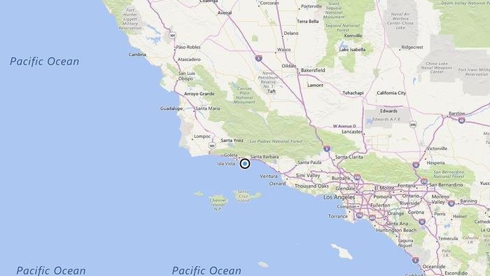
A map showing the location of the epicenter of Saturday morning's quake near Santa Barbara, Calif.
© Bing MapsA map showing the location of the epicenter of Saturday morning's quake near Santa Barbara, Calif.
A shallow magnitude 3.1 earthquake was reported Saturday morning three miles from Santa Barbara, according to the U.S. Geological Survey. The temblor occurred at 6:15 a.m. at a depth of 6.2 miles.

According to the USGS, the epicenter was five miles from Goleta, six miles from Isla Vista and 13 miles from Carpinteria.

In the last 10 days, there have been no earthquakes of magnitude 3.0 or greater centered nearby.

This information comes from the USGS Earthquake Notification Service and this post was created by an algorithm written by the author.

Igloo

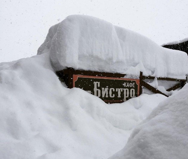
Record snow falls in Krasnaya Polyana, Russia; 27 inches above normal

Snowfall in Krasnaya Polyana
© Via Instrgram/janet_panova
An unusually snowy start to the season.

As a rule, in the middle of December snow depth in Krasnaya Polyana rarely reaches 30 cm (12 inches).

This year, it had already recorded 99 cm (39 inches) by 12 December!

Snowflake

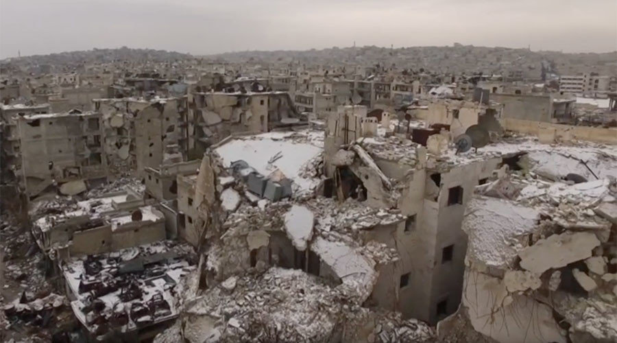
First snow of the season covers war-torn Aleppo as evacuations continue

Snow in Aleppo
© Ruptly
The first snow has settled on the smithereens of an Aleppo district as the last remaining militants depart the city they had inhabited for years.

The drone footage captured on Wednesday shows piles of rubble and partially destroyed houses covered with snow in the heavily-damaged Aleppo district of Seif Al-Dawla.

The district reportedly remains one of the last areas of the city to be partially controlled by militants. Syrian Arab Republic flags, however, can still be seen flying on a couple of ruined buildings.


Militants and civilians reportedly gathered to be evacuated.


Comment: There are also a countless numbers of road closures in Syria due to snow accumulation.


Solar Flares

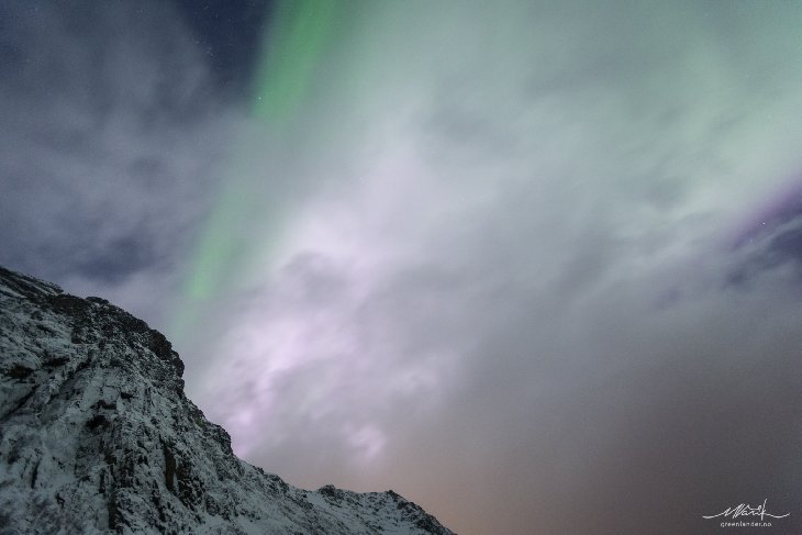
Veteran northern lights guide surprised to see rare pink and white auroras

Pink white aurora Tromso Norway Northern light aurora guide surprised December 2016
© Markus VarikPink or white auroras appear when energetic particles from space descend lower than usual
WHITE AURORAS? Auroras are usually green. Occasionally, other colors appear: red, purple, blue. One color that never shows itself, however, is white -- that is, not until last night. "I saw white auroras over Tromsø, Norway!" reports veteran observer Markus Varik. He recorded the phenomenon in this photo:

"I've been working more than 400 nights as a Northern Lights guide, and although sometimes I think I've seen it all, never have i witnessed white auroras like that," says Varik. "It was amazing to see it unravel white like that in front of my eyes. Pure magic!"

Auroras get their colors from specific elements in Earth's upper atmosphere. Green auroras, for instance, come from atomic oxygen; blue is associated with molecular nitrogen. No element produces white. So where did it come from?

Comment: From Spaceweather.com:

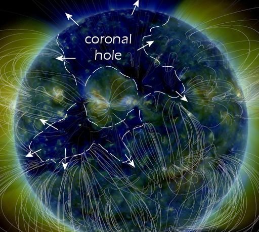
This is a "coronal hole"--a region in the sun's atmosphere where the magnetic field opens up and allows solar wind to escape. We've actually seen this coronal hole before -- at least twice. For the third month in a row, a large hole in the sun's atmosphere is turning toward Earth. It is rotating around with the sun, strobing Earth like a lighthouse every ~27 days. The last two times we experienced its solar wind (Oct. 25-28 and Nov. 23-26), G1- and G2-class magnetic storms sparked bright polar auroras.

For the third day in a row, Earth is inside a stream of solar wind blowing out of a large hole in the sun's atmosphere. This is causing magnetic unrest and bright auroras around the poles. NOAA forecasters estimate a 35% chance of G1-class geomagnetic storms on Dec. 24th.

Large coronal hole December 24th 2016
Also see:


Alarm Clock

Study: As Groundwater Dwindles, a Global Food Shock Looms

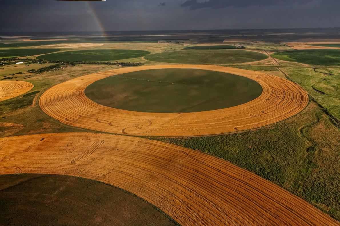
Center-pivot irrigation system in Kansas
© Randy Olson, National Geographic CreativeCenter-pivot irrigation systems irrigate fields of grain in Finney County, Kansas. Each well draws hundreds of gallons per minute from the sinking Ogallala aquifer.
By mid-century, says a new study, some of the biggest grain-producing regions could run dry.

Rising temperatures and growing demands for thirsty grains like rice and wheat could drain much of the world's groundwater in the next few decades, new research warns.

Nearly half of our food comes from the warm, dry parts of the planet, where excessive groundwater pumping to irrigate crops is rapidly shrinking the porous underground reservoirs called aquifers. Vast swaths of India, Pakistan, southern Europe, and the western United States could face depleted aquifers by mid-century, a recent study finds—taking a bite out of the food supply and leaving as many as 1.8 billion people without access to this crucial source of fresh water.

To forecast when and where specific aquifers around the globe might be drained to the point that they're unusable, Inge de Graaf, a hydrologist at the Colorado School of Mines in Golden, Colorado, developed a new model simulating regional groundwater dynamics and withdrawals from 1960 to 2100. She found that California's agricultural powerhouses—the Central Valley, Tulare Basin, and southern San Joaquin Valley, which produce a plentiful portion of the nation's food—could run out of accessible groundwater as early as the 2030s.

India's Upper Ganges Basin and southern Spain and Italy could be used up between 2040 and 2060. And the southern part of the Ogallala aquifer under Kansas, Oklahoma, Texas, and New Mexico could be depleted between 2050 and 2070. (Read more about the threat to the southern High Plains.)
Comment: As well as dwindling groundwater, with extreme weather becoming the 'new norm' food price increases seem likely in the near future.


Ice Cube

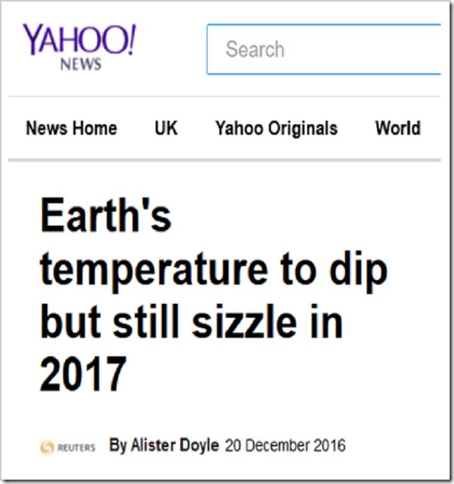
Earth 'sizzles' with record low temperatures!

h/t Patsy Lacey

Low Temperatures
Meanwhile back in the real world:

20 Dec 2016 - Heavy snowfall in Saudi Arabia - Such snow not seen for many years. Temperature below zero.


Snowflake Cold

Biting cold below minus 60C recorded in western Siberia

Such temperatures happen in eastern Siberia, but in the west they are more rare.
© Elina KadochnikovaSuch temperatures happen in eastern Siberia, but in the west they are more rare.
The freeze is so deep that horses - and even Rudolph - is brought indoors to warm up.

This is not a week when there was any evidence of global warming in western Siberia, with thermometers plunging to the minus 40s and minus 62 Celsius. Meteorologists say it may get colder still.

At Bolshoe Olkhovskoe oilfield there was a new record for the Khanti-Mansi region with a bone-crushing temperature of minus 62C. The village of Kazym in the same district of Beloyarsky hit minus 58C.

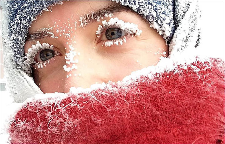
Eyelashes got frosty extensions from nature's own cosmetics, as our amazing pictures show. Beards turned prematurely white.

A video was posted entitled: 'Surgut men are so hardy they only ride on a swing and eat ice cream at minus 51C.'

In Nadym, it nudged minus 50C, and all schools were closed. In Tyumen, school classes were cancelled from grades 1 to 9, with minus 36C the trigger for children to stay home, although elsewhere in Siberia - for example Yakutia in recent weeks - students are still expected in school at below minus 52C.

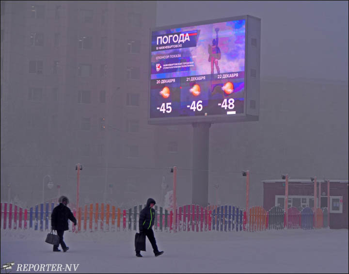
Nizhnevartovsk hit minus 50C, the coldest winter in ten years in the city. School classes were cancelled today - and for the rest of the week.

Such temperatures happen in eastern Siberia, but in the west they are more rare.

Cold Siberia

Snowflake

First snow in over 2 decades engulfs Antalya, Turkey

Snow in Turkey
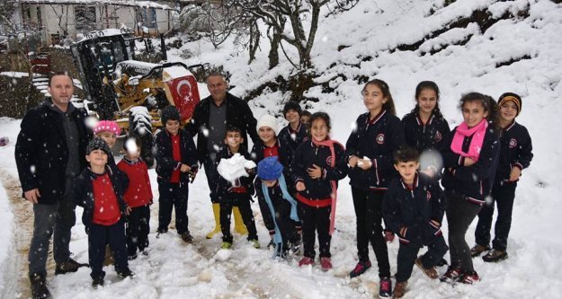
Antalya, one of the rare year-round sunny spots in Turkey, was taken over by snowfall yesterday and Wednesday, the first such precipitation since 1993.

The snowfall in the Turkish Riviera, a popular vacation spot, blocked roads and led to the closure of schools in four districts.

Tourists and locals were surprised by the sudden snowfall that has already paralyzed daily life in other parts of the country. Temperatures dropped as low as 3 degrees Celsius (37 degrees Fahrenheit), although the area was still hotter compared to the minus 20 degrees Celsius temperatures in eastern Turkey.

The snowfall particularly affected the higher areas in the city, Kepezüstü district in particular, which is located some 10 kilometers (6.2 miles) from central Antalya. Traffic on the road connecting central Antalya to the Korkuteli district also came to a halt due to heavy snowfall, which blanketed the natural and man-made beauties the city boasts, from the ancient city of Thermessos to the forests north of the city, which are situated along the Mediterranean coast.

Attention

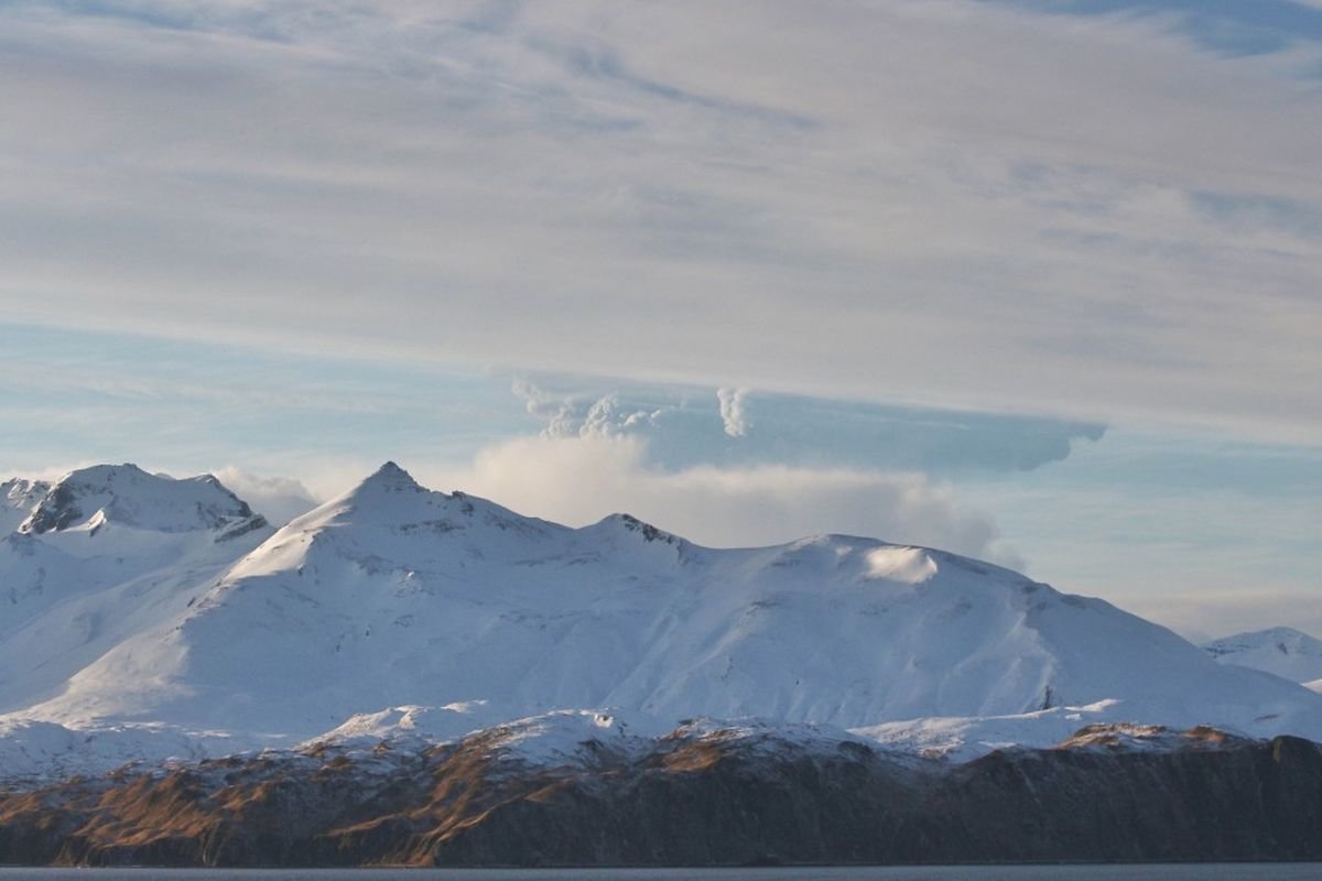
For second day running, Bogoslof volcano eruption sparks aviation alert in Alaska

A plume rises from Bogoslof volcano, partially obscured by a mountain on Unalaska Island, in this view from Unalaska, about 60 miles east of the volcano, on Wednesday, Dec. 22, 2016.
© Lynda Lybeck-RobinsonA plume rises from Bogoslof volcano, partially obscured by a mountain on Unalaska Island, in this view from Unalaska, about 60 miles east of the volcano, on Wednesday, Dec. 22, 2016.
For the second straight day, the Alaska Volcano Observatory issued its highest alert level for aviation when a volcano erupted with a towering ash cloud in the Aleutian Islands.

Observatory volcanologist Robert McGimsey says Wednesday afternoon's eruption of the Bogoslof volcano was "almost a carbon copy" of an eruption 24 hours earlier.

He tells The Associated Press that both eruptions prompted the highest alert level and both were downgraded hours after the events.

Tuesday's eruption sent ash and steam 34,000 feet into the air, while Wednesday burst went 1,000 feet higher. Officials say both volcanic explosions were also short-lived.

The observatory said early Thursday that it was reducing the alert level because there had been no recent volcano activity.

The volcano is located on an island of the same name in the Bering Sea about 850 miles southwest of Anchorage.

Source: AP

Ice Cube

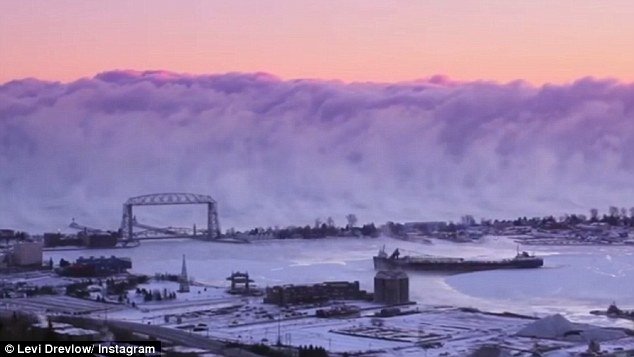
Wall of 'icy fog' appears at Lake Superior in Duluth, Minnesota

Wall of 'sea smoke' at Lake Superior
Wall of 'sea smoke' at Lake Superior.
In a rare atmospheric phenomenon, an enormous wall of icy fog has been filmed billowing over Lake Superior in Minnesota.

The fog was filmed by local photographer Levi Drevlow on December 18, and it looks like something out of a disaster movie, dwarfing a freighter in the port of Duluth as it fearlessly steers straight towards the snowy fog bank.

While scary-looking, the cloud is actually quite natural, the result of a quick temperature drop to -18 Celsius (about -0.4 Fahrenheit). The difference between cold air and warm water is what sent the dense vapor hundreds of feet upwards above the largest of North America's Great Lakes.

Comment: This is actually the second time it has happened there this year. (No, it doesn't normally happen there.)