Earth ChangesS


Snowflake Cold

Scientists buried in snow at Davos while giving lectures on global warming

Davos snow covered

Scientists have once again set up a mock Arctic base camp to educate world leaders about man-made global warming at the World Economic Forum in Davos, Switzerland.

Climate scientists hope their mock camp illustrates how global warming could impact the Arctic, but the "Gore effect" may make it harder to get the message across. Davos has seen frigid temperatures along with about six feet of snow in the last six days.

Comment: It's unsurprising that participants in the event were seemingly unaware of the irony. Global warming - buried in snow. What's wrong with this picture?

See also:


Snowflake

Changes in Arctic conditions point to another massive cold blast in Eastern US

Erie snow storm
© CNN
Paul Dorian sends word that there's a change brewing in the Arctic that may result in a massive and extended cold outbreak for the Northern hemisphere, much like what we saw in late December and early January when record breaking cold swamped the eastern USA. He writes:

Overview
We are now experiencing warmer-than-normal weather conditions in the eastern US and there will be mild spells right into the first week of February, but the signs are increasing for a return to a cold pattern next month and it may very well last for an extended period of time. The MJO is a tropical disturbance that propagates around the global tropics and it will be transitioning into "phases" during the month of February that are conducive to colder-than-normal weather in the eastern US. In addition, stratospheric warming will unfold over the next week or so in the polar region of the Northern Hemisphere and this can set off a chain of events in the atmosphere that ultimately results in colder-than-normal weather for the eastern US. There are other signals as well that support the notion of a return to cold in the eastern US and it very well could stick around for awhile.

arctic blast 1
00Z Euro forecast of the MJO index from today (lower arrow) to February 6th (upper arrow) which is displayed on a day-to-day basis by the green line.

Comment: If this develops into a another deep freeze blast, it will be the 3rd time this winter that has happened. See here and here. It seems that we are inching ever closer to beginnings of an ice age. See also:


Cloud Precipitation

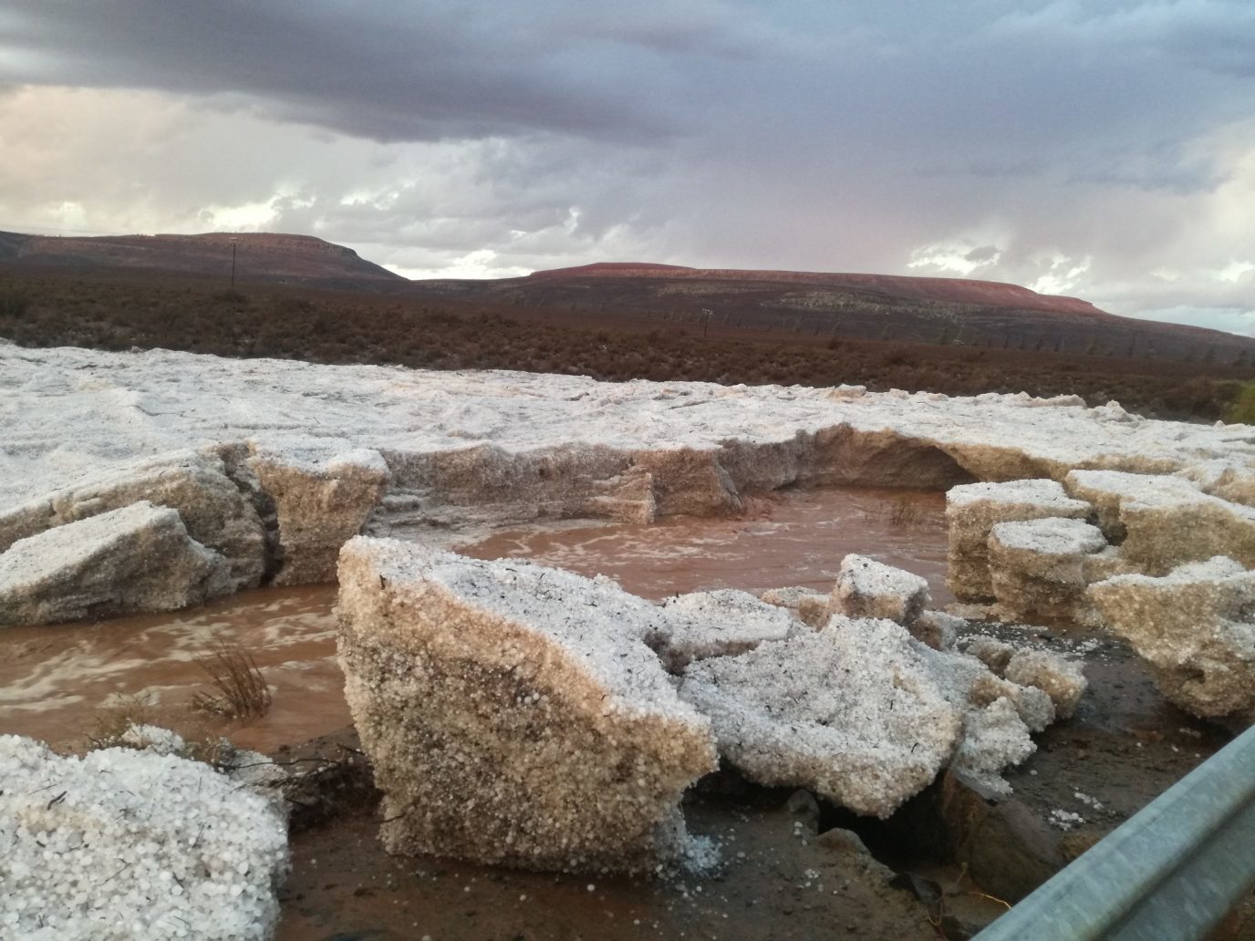
River of hail filmed in Sutherland, South Africa

A
© Starry Night SutherlandA "river of hail" ploughs its way through Sutherland, Northern Cape, South Africa
A rare phenomenon caused 'rivers of hail' through the town

As Cape Town gears up for day zero, many citizens are resigning themselves to dry dams and a complete shutdown of their taps. But, as we've seen in the Northern Cape, it may not be time to rule out a miracle just yet.

The NC territory is experiencing a drought just like its neighbour to the south. Resources have been stretched even across such a sparsely populated area. As reported by Good Things Guy, Sutherland was one town in the province that had been hit badly by the lesser-known water crisis.


Cloud Precipitation

Floods in the north of Mozambique leave 11 dead and affect 75,000

Flooding in Nampula, Mozambique.
© Marc Nosbach‏Flooding in Nampula, Mozambique.
The government in Mozambique said that heavy rain and flooding in northern areas of the country has left at least 11 people dead and affected over 75,000 people.

The provinces of Nampula, Niassa and Cabo Delgado have all seen heavy rain since 14 January, 2018, triggered by a tropical depression. The city of Nampula recorded over 450 mm of rain between 15 and 19 January.

Local media, quoting sources from Mozambique's National Directorate of Water Resources (DNRH) said that, as of 19 January, the Messalo, Megaruma and Monapo rivers had all burst their banks.

Snowflake Cold

Huge increase in snowfall over Antarctica say NASA, growing since 1900

2013-2014 MODIS Mosaic of Antarctica. Courtesy of National Snow and Ice Data Center and NASA.
© National Snow and Ice Data Center and NASA2013-2014 MODIS Mosaic of Antarctica.

Scientists have found large increases in snow accumulation in a vast region of eastern Antarctica, a trend that, if it continues or becomes more widespread, could lessen the ice sheet's contribution to sea level rise and mitigate one of the most feared consequences of climate change.

The study, conducted by scientists from NASA and several other institutions, examined snowfall in western Queen Maud Land, an area due south of the southern tip of Africa that is warming rapidly and contains 7 percent of Antarctica's ice.

Based on a more than 500-foot-long ice core extracted from the thick sheet and containing a snowfall record dating back 2,000 years, the researchers found snow accumulation levels had been rising since around 1900. And the increase is most marked in recent decades, up through the year 2010. It's a finding that aligns with the notion that climate change, by increasing the atmosphere's retention of water vapor, is increasing precipitation.

Comment: When we look at our planets recent history and compare it with our knowledge of Earth's climate and its cyclical nature, it's evident we're entering a cooling period, also known as an ice age: Also check out SOTT radio's: Ice Age Cometh? Extreme Weather Events and 'Climate Change'


Cloud Lightning

Lightning kills teenage boy in Malawi

lightning
A 14 year old boy in Nkhotakota district has died after being struck by lightning.

The boy, Yesaya Banda, is reported to have been killed by the lightning on his way to the lake for fishing.

Confirming the reports, Nkhunga Police spokesperson Ignatius Esau said Banda opted to go for fishing with his friend Mabvuto Phiri aged 12 on Monday.

"On their way, heavy rains started and lightning struck the two," said Esau.

He added that well wishers took the two boys to Ngala health center where Yesaya was pronounced dead while Mabvuto was referred to Nkhotakota District hospital for further treatment.

Cloud Precipitation

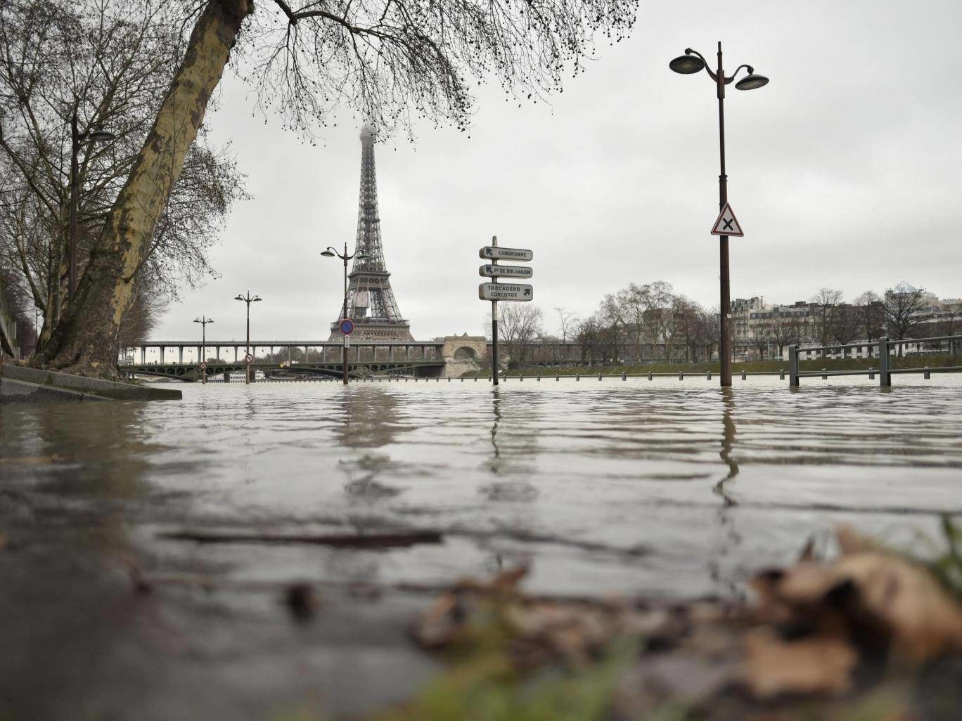
Paris braced for floods after heavy rain causes River Seine to burst banks

River Seine flooded
© Stephane De Sakutin / AFP / Getty ImagesA photo taken on 23 January shows flooded banks of the river Seine, which has overflown after torrential rain has battered Paris
Water rises to at least 3.3 metres above the normal level

Parisians have been urged to use "extreme caution" after the River Seine burst its banks and water levels rose at least 3.3 metres above the normal level.

Authorities closed several roads near the French's capital's City Hall and cancelled boat cruises as forecasters warned that the water is expected to keep rising in the coming days.

Expected to reach its peak later this week, fears are mounting that it could surpass the water level recorded in 2016, when the worst flooding seen in Paris for decades led to the closure of several monuments and tourist attractions including the Louvre.

Comment: According to The Local France, 29 departments in various parts of France were place on orange alert by Météo France earlier this week for the risk of flooding, downpours and avalanches.

In eastern France the Doubs and Jura were placed on red alert - the highest level of warning - for dangerous flooding. Météo France advised residents to remain in doors and avoid all unnecessary travel. "If people have to make a journey they must take all necessary precautions and follow any road diversions that have been put in place," Météo France says. The warning is due to the river Loue, which runs through both departments, having burst its banks.

The map below shows the other areas of France on orange - the second highest warning level - for flooding, which include Normandy as well as Paris and the surrounding Île de France region. Swathes of south west and north eastern France were also on flood warnings as downpours continued throughout Monday across much of the country.

France flood warnings
© The Local France


Snowflake Cold

Kazakhstan hit by Arctic chill, temperatures down to -40 degrees Celsius with 3 people freezing to death

Illustrative photo
A front descending from the Arctic has driven temperatures to around below 40 degrees Celsius. That's cold.

Northern Kazakhstan has succumbed to glacial conditions so extreme that is startling even many of the region's implacable residents.

Winter in the capital, Astana, is rarely anything but miserable, but this season is taking things to another level — the result, say scientists, of a front blowing in from the Arctic Ocean.

The actual temperature in Astana is around below 40 degrees Celsius, but weather apps on mobile phones warns people that it "feels" like below 50 degrees Celsius. That is in large part down to the fact that Astana is plonked right down in the middle of the open steppe and is accordingly open to being buffeted by cruel winds.


Snowflake Cold

Winter low of -44.5 deg C strikes Heilongjiang, China

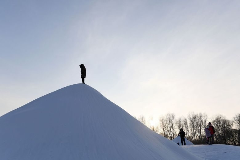
A visitor climbs a snow hill before the opening of the annual Harbin Ice and Snow Sculpture Festival in Harbin in China's northeast Heilongjiang province, on Jan 5, 2018
© APA visitor climbs a snow hill before the opening of the annual Harbin Ice and Snow Sculpture Festival in Harbin in China's northeast Heilongjiang province, on Jan 5, 2018
Temperatures hit a low this winter of -44.5 deg C in Mohe, China's northernmost county in Heilongjiang province, according to Mr Wu Shusen, a senior engineer at the county's observatory.

"The temperature over the following two days will be around -46 deg C and it is expected to drop to -47 deg C on Thursday," Mr Wu said. "Then the temperature will increase slightly on Friday."

The region, regarded as the coldest in China, usually sees winters lasting eight months. Its record low is -52.3 deg C.

It's my first time in Beiji village in Mohe where I originally planned to experience the extreme cold," said Ms Xia Tian, 29, a tourist from Hangzhou, Zhejiang province. "However, I never imagined that it would be so cold before I got here on Saturday."
Ambulance

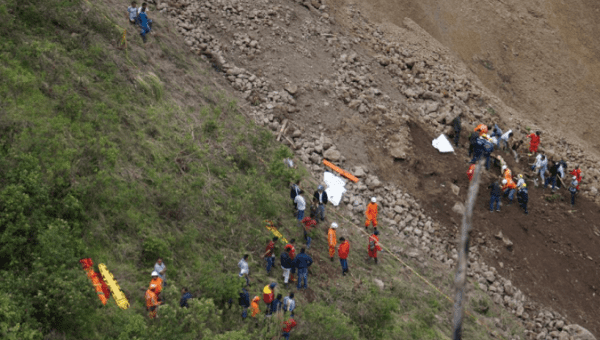
Mudslide pushes bus to ravine in Colombia killing 13

mudslide Colombia
© ReutersSearch and rescue operations underway at site of a landslide in Nariño, Colombia, January 21, 2018, in this picture obtained from social media.
Highway police officer Fernando Montana said there were five women and one baby among those on the bus, HispanTV reported.

Nearly thirteen people onboard a public bus have died on the Tumaco-Pasto highway in southwest Colombia as a result of a landslide.

The mudslide, prompted by heavy rainfall, occurred between the cities of Tumaco and Pasto, which are located in the Nariño district of Colombia bordering Ecuador.

The head of the disaster relief agency for the province told Reuters that the landslide sent some 5,000 cubic meters of rock and earth down on to the highway, pushing the bus into the ravine.

Comment: Another deadly mudslide in Colombia back in November:

At least four dead, 18 missing after mudslide in Corinto, Colombia