Secret HistoryS


Info

Researchers discover locations of ancient Maya sacred groves of cacao trees

Findings show links among cacao cultivation, religion, power in region.

Researcher Chris Balzotti
© Photo by Richard TerryResearcher Chris Balzotti climbs an ancient staircase discovered in a sinkhole near Coba, Mexico.
For as much as modern society worships chocolate, cacao โ€” the plant chocolate comes from โ€” was believed to be even more divine to ancient Mayas. The Maya considered cacao beans to be a gift from the gods and even used them as currency because of their value.

As such, cacao bean production was carefully controlled by the Maya leaders of northern Yucatan, with cacao trees only grown in sacred groves. But no modern researcher has ever been able to pinpoint where these ancient sacred groves were located โ€” until now.

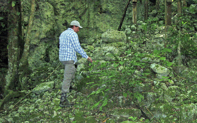
Researchers at Brigham Young University, including professor emeritus Richard Terry and graduate students Bryce Brown and Christopher Balzotti, worked closely with archaeologists from the U.S. and Mexico to identify locations the Maya used to provide the perfect blend of humidity, calm and shade required by cacao trees. While the drier climate of the Yucatan peninsula is inhospitable to cacao growth, the team realized the vast array of sinkholes common to the peninsula have microclimates with just the right conditions.

As detailed in a study newly published in the Journal of Archaeological Science Reports, the team conducted soil analyses on 11 of those sinkholes and found that the soil of nine of them contained evidence of theobromine and caffeine โ€” combined biomarkers unique to cacao. Archaeologists also found evidence of ancient ceremonial rituals โ€” such as staircase ramps for processions, stone carvings, altars and offerings like jade and ceramics (including tiny ceramic cacao pods) โ€” in several sinkholes.

Comment: It brings to mind a reference Graham Hancock makes in his book America Before that in the Amazon rainforest food crops like the Brazil nut and the ice cream bean tree are in such abundance when compared to other species of plant that researchers believe that they must have been intentionally cultivated: Also check out the MindMatters podcast on the book mentioned above: MindMatters: America Before: Comets, Catastrophes, Mounds and Mythology


Books

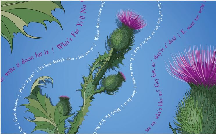
How the English failed at stamping out the Scots language

poster scots language
© Atlas Obscura
Over the past few decades, as efforts to save endangered languages have become governmental policy in the Netherlands (Frisian), Slovakia (Rusyn) and New Zealand (Maori), among many others, Scotland is in an unusual situation. A language known as Scottish Gaelic has become the figurehead for minority languages in Scotland. This is sensible; it is a very old and very distinctive language (it has three distinct r sounds!), and in 2011 the national census determined that fewer than 60,000 people speak it, making it a worthy target for preservation.

But there is another minority language in Scotland, one that is commonly dismissed. It's called Scots, and it's sometimes referred to as a joke, a weirdly spelled and -accented local variety of English. Is it a language or a dialect? "The BBC has a lot of lazy people who don't read the books or keep up with Scottish culture and keep asking me that stupid question," says Billy Kay, a language activist and author of Scots: The Mither Tongue. Kay says these days he simply refuses to even answer whether Scots is a language or a dialect.

What Scots really is is a fascinating centuries-old Germanic language that happens to be one of the most widely spoken minority native languages, by national percentage of speakers, in the world. You may not have heard of it, but the story of Scots is a story of linguistic imperialism done most effectively, a method of stamping out a country's independence, and also, unexpectedly, an optimistic story of survival. Scots has faced every pressure a language can face, and yet it's not only still here โ€” it's growing.

Bizarro Earth

Death, pain and injustice: How British soldiers massacred scores of civilians in the UK - Bloody Sunday

bloody sunday
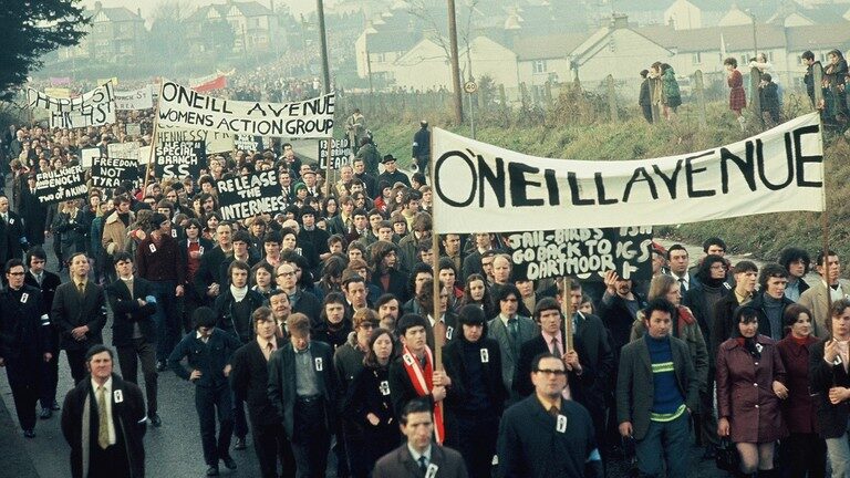
© Getty Images / William L. RukeyserFILE PHOTO. Thousands march with the Northern Irish Civil Rights Assn. in Newry during a civilian protest organised in response to the shooting of 14 civilians by British paratroopers the week before, 2nd February 1972.
For the first time in 50 years, the crowds gathering in Derry this weekend to remember the events of the day forever known as Bloody Sunday will have some certainty. Certainty that the innocence of the 13 men and boys murdered on January 30, 1972 has been acknowledged, but also certainty that true justice has eluded them.

But that won't stop the families of those killed and wounded by trigger-happy British Parachute Regiment soldiers in half an hour of bloodshed from celebrating what they've achieved in the years since. And it hasn't stopped Enniskillen-born actor Adrian Dunbar, star of the hit TV police drama 'Line of Duty' from accepting an invitation to talk to his fellow Northern Irishmen and women on Sunday as they meet together to remember the past and pray for the future.

Comment: See also: And check out SOTT radio's:


Star of David

Al Tantura: The memory of colonization

Dor Beach building
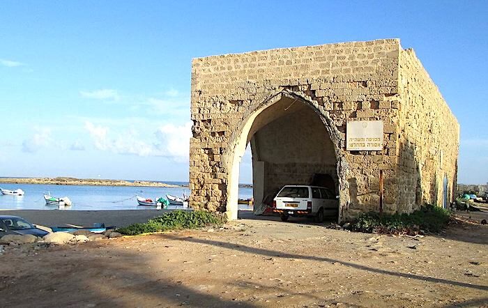
© Dr. Avishai Teicher PikwikiA building still standing from Al-Tantura at Dor Beach near Kibbutz Nahsholim
"We don't need their acknowledgment," says Salah Abu Salah, a survivor of the Al-Tantura massacre. "The land will testify one day and tell what happened."

In the early stages of 1948, the village of Al-Tantura was targeted by Israeli militaries; its houses were looted, its Arab Palestinian inhabitants expelled, and others massacred by the Israeli defense forces Alexandroni Brigade. Israel denied the existence of the massacre for years despite the testimonies of its original inhabitants until recently; a 2021 Israeli documentary revealed testimony from several Israeli veterans affirming that a massacre involving more than 200 Palestinian victims had taken place at that time.

The original inhabitants of Tantura were forced to move to different places; most of them had relatives 50 km away in a town called Fureidis (which translates as "Paradise"), and they had no choice but to live with them. While revisiting the story of Tantura, Salah Abu Salah, who was 8 years old at the time, told me how his family and other families had to move to Fureidis seeking shelter.

In recounting his story Abu Salah told me that after the Israeli defense forces took their homes, "They put us all on a bus and took us to a nearby village and left us there." For his luck, Abu Salah's mother had family that lived in Fureidis and they welcomed them to stay with them; other families had nowhere to seek shelter, so they were forced to leave to other areas, and some even fled to Jordan. The mukhtar (the head of the village) of Fureidis was from the Bariyeh family and had no choice but to open the town to Tantura refugees and urge people to shelter them.

SOTT Logo Radio

SOTT Focus: MindMatters: The Creativity and Humanity of John Lennon

beatles lennon
Peter Jackson's excellent new documentary Get Back provides an inside view of one of legendary rock band The Beatles' last recording sessions and their final public performance. Inspired by our viewing of the three-part documentary, today on MindMatters we discuss our thoughts about not only the Beatles and the nature of creativity, but also musical giant John Lennon's incredible artistry, the role he chose for himself post-Beatles, and how he chose to make constructive use of his considerable fame and talent to raise political awareness.

Few artists in history are gifted with such creativity and influence so as to make them the enemy of presidents and intelligence agencies, and yet that was exactly what John Lennon was before his life was cut tragically short by so-called 'lone nutter' Mark David Chapman. What Lennon might have done with a full life one can only, sadly, speculate. But we can look back at his all-too-brief life, celebrate his accomplishments, acknowledge his flaws, and recognize the power he had to move millions with his heart and with his message.


Running Time: 01:04:47

Download: MP3 โ€” 89 MB


Better Earth

Ice-age remains near Sea of Galilee show ancient residents thrived as ice melted

ice age galilee
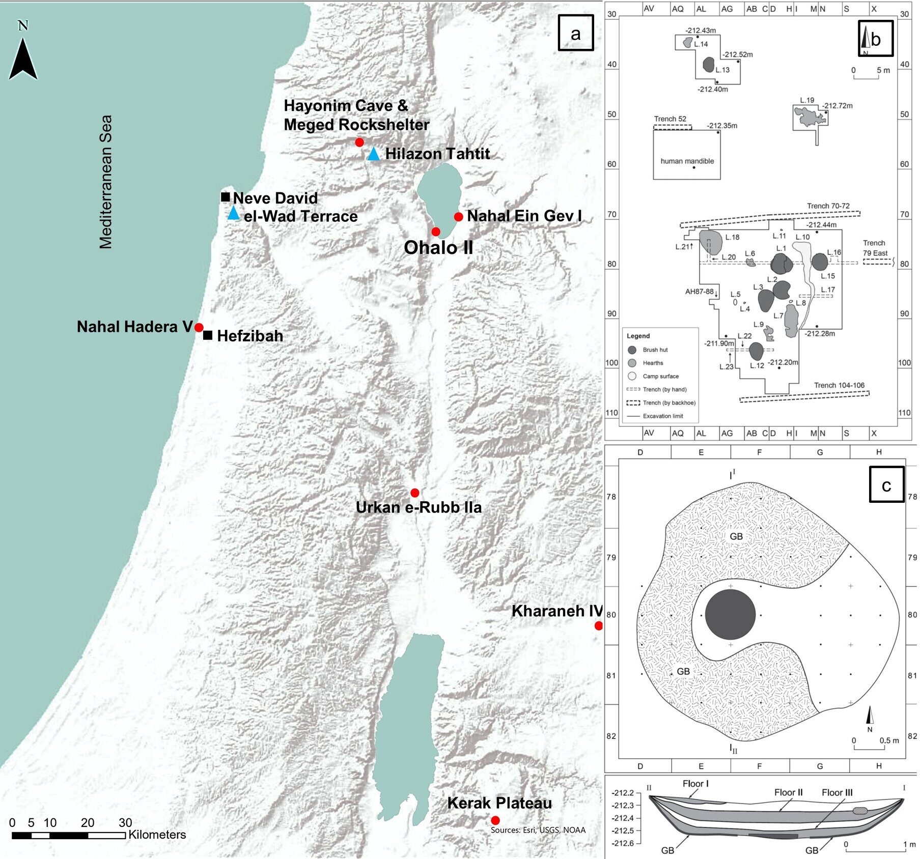
© Steiner et al., 2022, PLOS ONE, CC-BY 4.0 (creativecommons.org/licenses/by/4.0/)Early Epipaleolithic sites are marked with red circles, Middle Epipaleolithic with black squares and Late Epipaleolithic with blue triangles.
A new article published today in PLOS ONE by a Hebrew University of Jerusalem (HU)'s Institute of Archaeology team and colleagues focused on the remains of a previously submerged fisher-hunter-gatherer camp on the shores of the Sea of Galilee from around 23,000 years ago. Through a close analysis of the abundance, variety and through use of animal remains, the team concluded that these survivors of the latest Ice Age thrived whereas most of their contemporaries, in other parts of the world, were nearly starved, due to the Earth's extremely cold temperatures.


Comment: As Pierre Lescaudron details in Of Flash Frozen Mammoths and Cosmic Catastrophes, since then, a series of cataclysmic events have shifted our planet's latitude:
The above strongly suggests that before the Younger Dryas, the North geographic pole was located around Hudson Bay, which is about 60ยฐ North - that is; 30 degrees in latitude away from the current North pole.

But the peculiar Laurentide ice sheet is not the only evidence we have. The study of fossils provides a very good idea of what kind of plants and animals lived in different locations of the planet right before the Younger Dryas. This research tends to confirm that, at the end of the Pleistocene, the North pole was located in Hudson Bay.

Indeed, before the Younger Dryas, the Arctic Ocean was a temperate ocean (as indicated by the presence of Foramainifera in sea cores), Siberia was a temperate region (as indicated by human remains, entire forests and temperate flora), and Japan was warmer than today (as indicated by flora that grows in temperate climate and by the corals of Okinawa).

The Israeli site, known as Ohalo II, was occupied at the end of the last Ice Age ("Last Glacial Maximum"), between 23,500 and 22,500 years ago. Ohalo II is known for the excellent preservation of its brush huts and botanical remains. The study, led by HU doctoral student Tikvah Steiner, under the supervision of HU Professor Rivka Rabinovich and University of Haifa archaeologist Prof. Dani Nadel who excavated the site, examined the diet and extensive use of animal parts to determine the welfare and lifestyle of these ancient inhabitants.

Comment: See also: And check out SOTT radio's:


Info

Possible lunisolar calendar systems at Gobekli Tepe and Karahan Tepe

The following manuscript will soon be submitted for peer-review to an academic journal. It is reproduced here with the permission of the journal. Please see the acknowledgments section for proper attribution of ideas.

ABSTRACT

Gobekli Tepe is a remarkable ancient archaeological site in southern Turkey featuring several sub-circular temple-like enclosures adorned with many carved symbols. The oldest radiocarbon date obtained, so far, for the site places one of its enclosures, Enclosure D, at the Epipalaeolithic-Neolithic boundary, circa 9,500 BCE. Earlier work provided an astronomical interpretation for some of its symbolism, focussing on the animal symbols which were interpreted in terms of familiar constellations.

Here, that earlier interpretation is extended by showing how V-symbols on Pillar 43 in Enclosure D, in particular, can be interpreted in terms of a lunisolar calendar system, which would make it the oldest known example of its type. Furthermore, it is shown that a stone 11-pillar pool structure at neighbouring Karahan Tepe can also be interpreted in terms of the same lunisolar calendar system.

Other V-symbols at Gobekli Tepe are also interpreted in astronomical terms. Finally, it is shown how the Urfa Man statue and a carving at Sayburc can be interpreted as time-controlling or creator deities. Symbolic links with later cultures from the Fertile Crescent are explored.
Pillar D
© Image courtesy of Alistair CoombsFigure 1. Left: Plan of Enclosures A to D at Gobekli Tepe. Right: Pillar 43 at Gobekli Tepe, Enclosure D.

Stop

Across the Muslim world, Islamism is going out of vogue

Jakarta protest
© Wikimedia CommonsA protest in Jakarta, Indonesia, 2017
Though the Taliban has once again taken power in Afghanistan, they have come back at a rather inopportune time. Across the Muslim world, many seem to be souring on Islamists, defined as those who derive legitimacy from Islam and advocate for modern states to be governed along Islamic precepts, both economically and judicially. Over the last few years, Islamist governments have fallen out of power across the Middle East and Africa, haemorrhaged support in Turkey, and failed to make headway in Southeast Asia.

Islamism was once seen as an unstoppable force throughout most of the Muslim world, its proponents representing the most organized and influential voices in opposition to the often corrupt and incompetent secular leadership of Muslim countries. In more authoritarian states, mosques regularly served as one of the few "safe spaces" for citizens to vent their disenchantment about the state of society, ensuring the institutions of Islam a prominent place in the larger anti-statist opposition. Many Islamist groups further amass popular support by filling the gap left behind by woefully inadequate welfare systems and, in turn, providing their own social services, including schools and hospitals.

The issue is that once Islamists manage to get themselves into power, they frequently prove incapable of delivering on their promises. Islamist governments have often been, at best, incompetent and out-of-touch (as has been the case in the Arab world) and at worst, economically disastrous (as has been the case in Turkey and Sudan). In the more consolidated democracies of Malaysia and Indonesia, Islamist movements are fractious and riven by internal divisions and overly ambitious leaders. The Taliban may be back, but it would be a mistake to overstate the power of Islamist movements around the world.

Info

Archaeological discoveries show Poverty Point is more complex than previously known

Poverty Point Samples
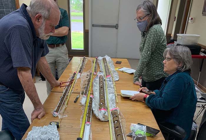
© Photo courtesy of Rinita DalanExamining soil core samples at Poverty Point World Heritage Site are, from left, Thurman Allen, a soil scientist retired from the Natural Resources Conservation Service; Mark Brink, Poverty Point WHS manager; Rinita Dalan, Ph.D., of Minnesota State University Moorhead; and Diana Greenlee, Ph.D., Poverty Point WHS station archaeologist, and ULM adjunct professor.
These earthworks, together with a buried, mound-like feature with unique soil properties unlike any of the known earthworks at the site, demonstrate that the Plaza at Poverty Point has a more elaborate construction history than we knew.

Diana Greenlee, Ph.D.
Poverty Point World Heritage Site is slowly revealing her secrets.

Diana Greenlee, Ph.D., station archaeologist at the ancient monumental earthworks and adjunct professor at the University of Louisiana Monroe School of Sciences, said recent archaeological research shows the site is "much more complex than previously realized."

The joint project by ULM and Minnesota State University Moorhead (MSUM ) was funded with a 2019 Preservation Technology and Training Grant from the U.S. Dept. of the Interior, National Park Service.

Greenlee, Rinita Dalan, Ph.D., of MSUM, and their colleagues focused on Poverty Point's central Plaza. This 43-acre area was created thousands of years ago by removing the original topsoil and then adding fill dirt to build a raised, near-level surface. To look at the Plaza today, one would not suspect what is hidden below.

Parts of the Plaza were surveyed using a sophisticated ground penetrating radar developed in Norway and used extensively by the Norwegian University of Science and Technology. Arne Anderson Stamnes, Ph.D., of the university's Terrestrial, Marine, and Aerial Remote sensing for archaeology research group, operated the GPR.

Nearly 2,000 reflectors, which are objects or soil disturbances that reflect the radar signals, were identified. These results were compared to other geophysical surveys.

Then, several targets were tested using a combination of soil coring, analyses of soil samples, and sieving for artifacts, and by lowering a geophysical sensor down the cored holes.

SOTT Logo Radio

SOTT Focus: MindMatters: Wall Street and the Russian Revolution, with Richard B. Spence

richard spence
History is rarely cut and dried, but important historical events are quite often portrayed in a very limited context, providing a very narrow understanding of how the world actually works. Or how the omission of a certain set of facts can almost completely upend our 'map of reality'; the commonly understood factors which brought about the Russian Revolution of 1917 being just such a story.

When we can begin to ask whether or not the U.S. government was actively engaged in undermining the Tsarist power structure in Russia, or how, at the same time, some of the largest and most powerful figures in American banking and industry helped organize and fund radical left causes there, or how U.S.-based media magnates twisted the news out of Russia to fit the agendas of the above - then we may start getting somewhere..

This week we speak with author and historian Richard B. Spence about his book Wall Street and the Russian Revolution, and delving into the data, agendas and dynamics that led to what is arguably one of the most profoundly destructive developments of the 20th century. And if the broader picture presented is more accurate than the more simplistic view, then we will surely be better equipped to see and understand what it is the Western world may be experiencing right now.


Running Time: 01:52:05

Download: MP3 โ€” 154 MB