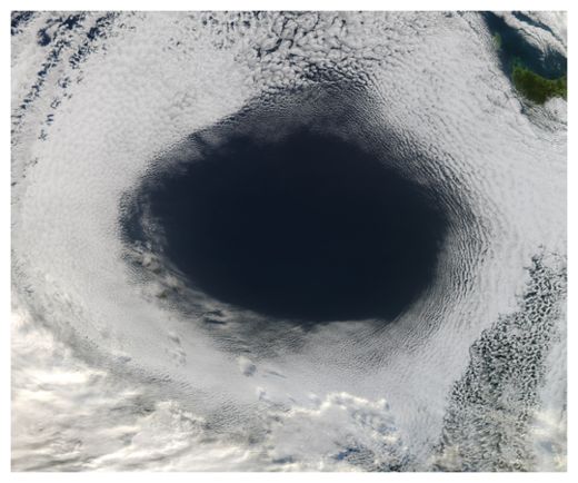
Analysis by NASA scientists found that the hole was caused by sinking air associated with a high pressure system off the surface of the Great Australian Bight, a huge bay to the continent's south. The oval-shaped hole was cut out from a blanket of marine stratocumulus clouds.
High pressure systems often bring fair weather and clear skies, and that's just what this one did, in spectacular fashion. "You could call it an anti-storm," said NASA atmospheric scientist Patrick Minnis in a statement.
In general, winds blow outward from areas of high pressure. As a result, areas of high pressure pull air downward. As the air sinks it also grows warmer, increasing the rate of evaporation and making it difficult for the air to hold clouds.
High pressure systems - which are sometimes called anticyclones - can yield large circular areas of clear skies. Areas of low pressure, by contrast, pull air upward and generate clouds and stormy weather, often producing circular cyclonic storms and clouds.
Sea-level pressure maps published by the Australian Bureau of Meteorology June 5 showed that the shape of the cloud hole matched the shape of the high pressure area.
According to NASA Goddard atmospheric scientist Joanna Joiner, weather models predicted the cloud formation nearly perfectly. "We checked the Global Modeling and Assimilation Office (GMAO) forecast, and it really nailed the system," Joiner said.


I bet there is a strong electromagnetic surge right in the center of the symmetrically oriented vapor fomartion.