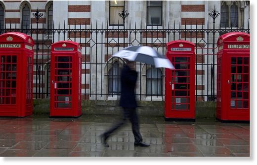
© REUTERS/Olivia Harris
Forecasters said "power showers" hammered many parts over the weekend, with lightning and mid-air tornadoes - narrow funnel clouds stretching below thunderstorms - reported in Lincolnshire and East Anglia.
The Met Office forecast heavy rain today and torrential downpours and gales on Wednesday and Thursday.
There were warnings of localised flooding in the south and more than an inch of rain today, with close to an inch on Wednesday. Parts face two inches' rain, their usual total for the whole of April, in just 72 hours.
The Environment Agency will consider flood warnings, but said downpours have no impact on the drought. Experts say rain has been sucked up by thirsty plants, evaporated or run off rock-hard soil.
April, set to be the wettest since 2000, has already seen 55mm of rain - more than the 54mm average for the whole month.
Temperatures are several degrees below the 10-13C average in parts, peaking at only 8C in eastern England on Saturday, with yesterday a degree or two milder but tomorrow seeing 8C again. Scotland is colder in places.
Chilly nights are falling close to freezing in some regions, with Scotland due more snow over higher ground. Around 1,000 out-of-season skiers hit the slopes at the weekend at Glencoe and Cairngorm, staging slalom races.
Met Office figures show this month's central England temperature has averaged just 7.0C - with a miserable forecast putting the month on course for the coldest April since 1989's 6.6C.
This month is on track to be one of the coldest Aprils since records began in 1659 - colder than four out of five Aprils since then. It is 4C colder than April 2011, the hottest ever at 11.8C, and 0.4C colder than average. Central England covers the area between London, Manchester and Bristol.
The Met Office warned most parts will not see above-average temperatures during the next two weeks, with mid-May cooler than average for most. Independent forecasters WeatherAction predict the coldest May in a century.
Netweather forecaster Paul Michaelwhite said: "April is living up to its reputation - with 'power showers' meaning anyone leaving home has needed waterproofs.
"Monday will see more persistent rain, with more showers or longer spells of rain throughout the week."
Netweather forecaster Nick Finnis said: "Weekend thunderstorms saw hail up to marble-size, lightning, torrential downpours and funnel clouds, with even weak tornadoes possible."
Weather Channel forecaster Leon Brown said: "Monday will be very wet, with as much as 30mm of rain - more than half the monthly average - from Devon to West Sussex, with a localised flood risk.
"Another band of heavy rain on Wednesday will see another 10-20mm fall, with the risk of further localised flooding in southern England."
The Met Office said: "Sunday saw heavier showers with longer outbreaks of rain and a risk of hail and thunder.
"The next week will continue unsettled with showers and longer periods of rain affecting most places. It will become windy on Wednesday, with persistent rain across many areas on Wednesday and Thursday, particularly the south."
Environment Agency head of water resources Trevor Bishop said: "It will take more than two weeks' rain to undo effects of two years' below-average rainfall.
"Soil is dry so most rain is soaked up used up by plants, evaporates or runs off, causing flash floods. Rain won't soak down to top up groundwater, which is what we really need."
Reader Comments
to our Newsletter