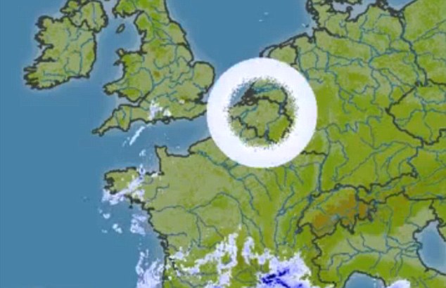
But fear not, aliens have not invaded Belgium.
These circular cloud formations on weather radar images are in fact caused by freak weather conditions disrupting radar antennae.

That causes the white ring that stretches out to limit of the radar's range. The clear inside of the ring is dependent on the angle at which the radar aerial points at the sky.
The images only show up on radar screens for a split second because weather radars only emit a signal for seven seconds out of every hour.
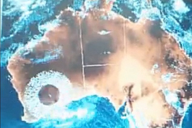
Similar patterns have been picked up on radar over Western Australia.
'That doughnut or ring is something called a melting circle, where snow melted and radar picks it up - it's a very thick area that forms an anomalistic ring,' Marc Dantonio of the Mutual UFO Network told AOL News.
'The radar only has a certain range out to which it can go -- that's the outer border of the doughnut. And the inner border of the doughnut is based on the angle that the radar is aiming in the sky,' Dantonio said.
And he warned any budding UFO hunters that weather radar can return a huge number of strange shapes caused by freak atmospheric conditions.
Comment: Wait a second. But wouldn't a huge number of anomalous atmospheric conditions deserve at least some attention? Perhaps a serious, interdisciplinary and free of agendas research into their possible nature or cause? And, no, dear readers, we are not talking about HAARP (as in HAARP being weather modification program, which is a red herring to keep people distracted from the real terror of the situation).
Coastal weather radars can pick up large ocean swells which appear as a series of straight lines behind each other.


..the "real" terror of the situation?