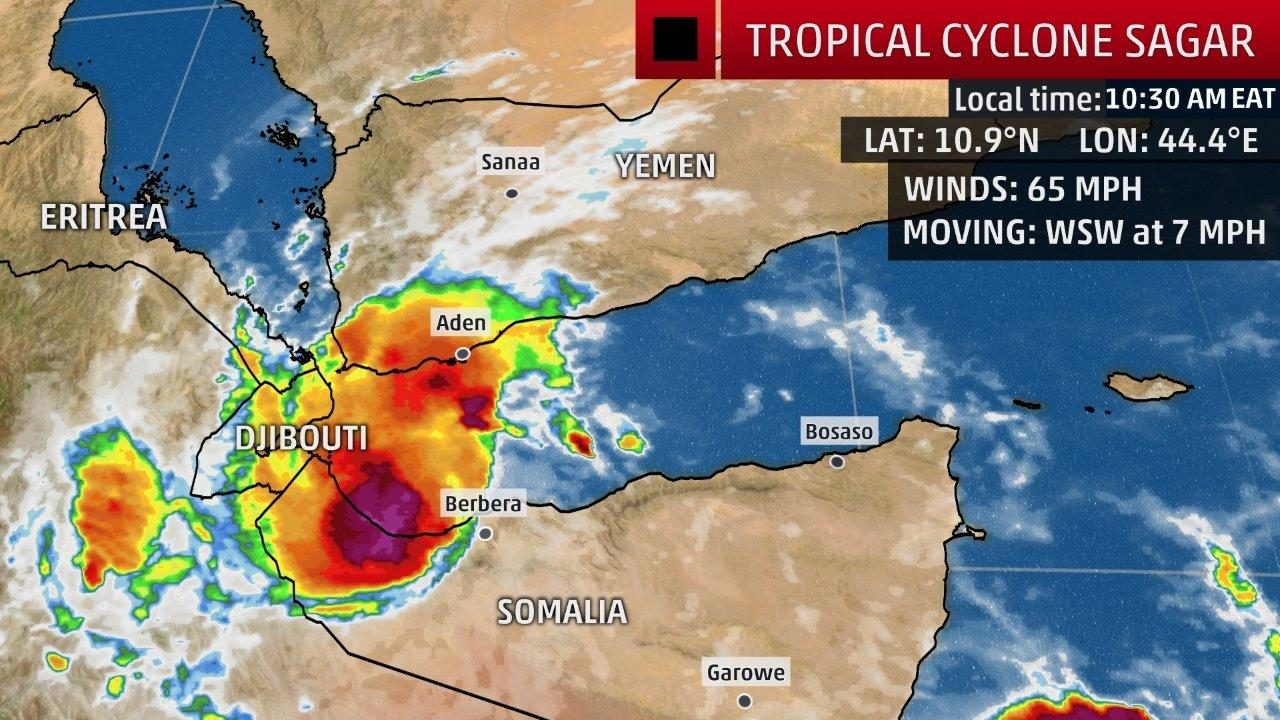
Tropical Cyclone Sagar is making a rare journey into the western Gulf of Aden between the Arabian Peninsula and the Horn of Africa, and is expected to unleash dangerous flash flooding in parts of Yemen, Somalia and Djibouti into the weekend.
Tropical Depression 1A was named Sagar by the Indian Meteorological Department, the agency with primary responsibility for tropical cyclone forecasting in the North Indian Ocean, including the Arabian Sea. Locally, it is known as Cyclonic Storm Sagar.
As of Friday evening, local time (Yemen is 7 hours ahead of U.S. EDT), Sagar is a small, compact tropical cyclone with winds estimated at tropical storm force, according to both the Indian Meteorological Department and the U.S. Joint Typhoon Warning Center.
At least one elderly woman was killed near Aden, Yemen when her house caught on fire caused by Sagar, according to the Associated Press.

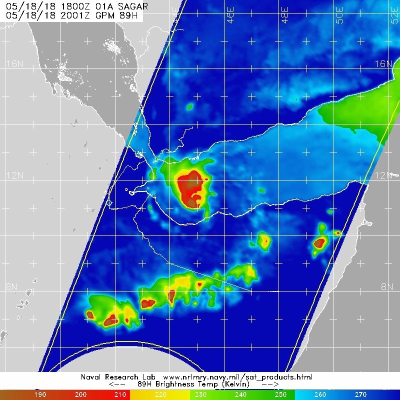
Sagar continues to exhibit a tight core of convection with some outer rainbands occasionally moving into parts of the Yemeni and northern Somali coasts. An eyewall was even trying to build in afternoon satellite imagery.
Sagar has gained some strength, according to satellite intensity estimates, taking advantage of a favorable environment of low wind shear and water temperatures up to 31 degrees Celsius (87.8 degrees Fahrenheit).
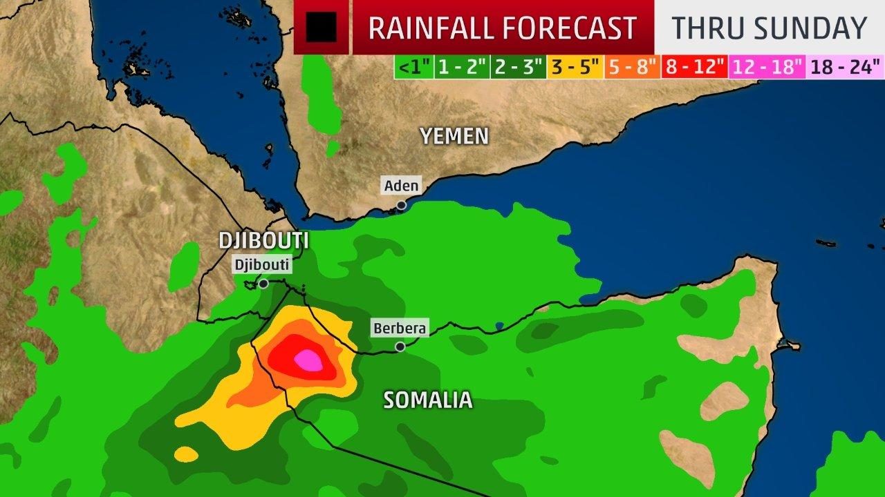
The main danger from Sagar will be heavy rainfall, with parts of northwest Somalia, northeast Ethiopia and possibly Djibouti picking up 3 inches or more of rain.
The emergency center of Yemen's Health Ministry reported that flash flooding is causing sewage to pour into the streets of Aden, Yemen, according to the Associated Press.
These are substantial totals in desert environments that don't typically get much moisture, and where the rugged landscape is prone to flash flooding. For instance, the average yearly rainfall in Djibouti City is only around 6.4 inches (163.5 millimeters).
Fisherman have been asked to stay out of the Gulf of Aden due to the rough seas and gusty winds.
In a special advisory issued Wednesday and posted by reliefweb.org, the UK Met Office warns that "severe flash flooding and river flooding across the region will lead to a loss of human life, livestock, and the destruction of crops, property and infrastructure." The Met Office added: "Very heavy rainfall occurring across Western Yemen (linked to, although not directly from the cyclone) is likely to promote cholera infection rates in the weeks ahead."
In addition to flash flooding, the Food and Agriculture Organization of the United Nations says the heavy rains could cause favorable breeding conditions for desert locusts, according to the Associated Press.
"Monitoring tropical cyclones in the Arabian Sea and Gulf of Aden is a very important part of this strategy because historically they have been the origin or trigger of Desert Locust plagues," according to Keith Cressman, the Senior Locust Forecasting Officer at the UN Food and Agriculture Organisation.
A Rare Track?
Sagar's center is expected to move ashore in northwest Somalia Saturday afternoon, local time, at tropical storm intensity, potentially weakening a bit as its circulation begins to interact with land and ingest some drier, desert air, according to the Joint Typhoon Warning Center.
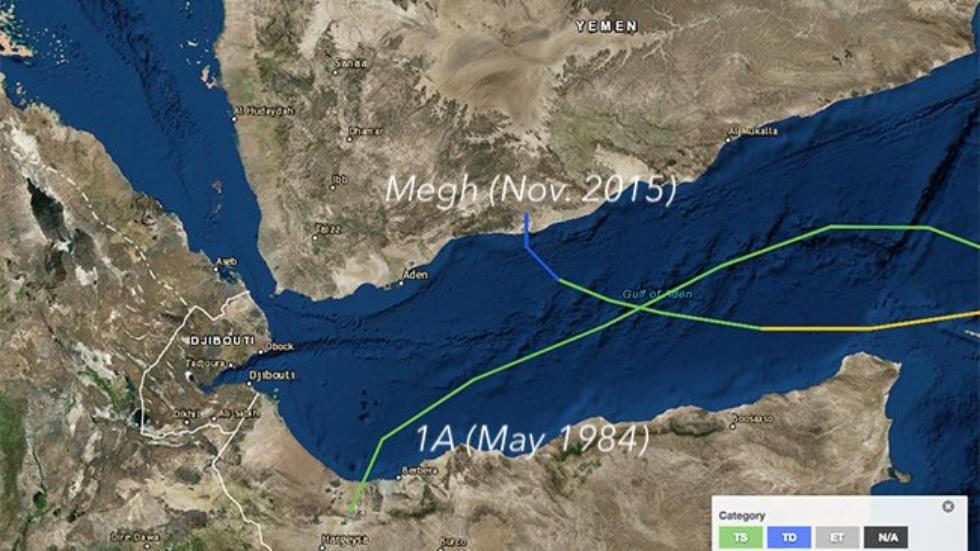
A tropical cyclone track this far west in the Gulf of Aden is exceedingly rare.
Since satellite surveillance of tropical cyclones began in 1966, only two other tropical cyclones have moved into the western Gulf of Aden, according to NOAA's historical hurricane tracks database.
Cyclone Megh, the second of back-to-back tropical cyclones that hammered Socotra Island, east of Somalia, made landfall along the Yemeni coast in November 2015.
Tropical Cyclone 1A traversed almost the entire Gulf of Aden before landfalling in northwest Somalia on May 28, 1984.

Tropical cyclones are most common in the Arabian Sea in spring and autumn, during the transition periods between the strong southwest flow of the summer monsoon and the strong northeast flow that predominates in winter.
On average, the Arabian Peninsula is affected by a tropical cyclone every year or two.


Reader Comments
to our Newsletter