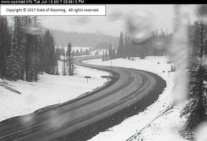
Late Season Accumulating Snow Expected for Western Wyoming Late tonight and Tuesday
The low pressure center will be tracking northeast across Yellowstone Park tonight. This low will be producing numerous showers and thunderstorms this evening. Sharply colder moisture laden air will be circulating around the back side of this low as the low tracks northeast into Montana. This much colder air will lower snow levels all the way down to the valley floor at times by Tuesday morning.
Snow amounts will likely range anywhere from from 4 to 12 inches above 7500 feet along with some isolated amounts of up to 14 inches in the Tetons by Tuesday evening. 1 to 3 inches of snow is expected to accumulate in the Western Wyoming Valleys by Tuesday before melting off Tuesday afternoon.
Teton and Gros Ventre Mountains - Mon Jun 12 2017
WINTER WEATHER ADVISORY IN EFFECT FROM MIDNIGHT TONIGHT TO 6 PM MDT TUESDAY
The National Weather Service in Riverton has issued a Winter Weather Advisory for the Teton and Gros Ventre Range, which is in effect from midnight tonight to 6 PM MDT Tuesday.
* TIMING...Numerous rain showers and thunderstorms will begin to mix with snow between 6 and 9 pm this evening.
The showers and thunderstorms will transition to more of a steady precipitation after midnight. The precipitation should be all snow after 12 midnight tonight.
Snow, heavy at times will continue through the day Tuesday.
* TOTAL SNOWFALL...6 to 12 inches in the Tetons along with isolated amounts of 14 inches. 4 to 11 inches on the Gros Ventre Range.
* MAIN IMPACT...Highway 22 over Teton Pass will likely become slick and snow covered. 20 to 30 mph winds along with 40 mph gusts could produce blowing and drifting snow. Wind chills will likely be as low as 15 to 25 degrees in exposed areas.
Thanks to Kenneth Lund for this link.


Reader Comments
to our Newsletter