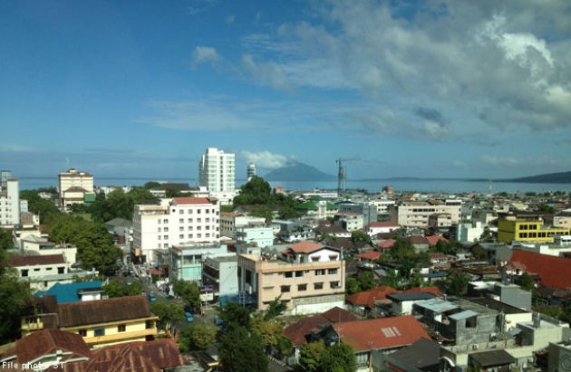
© News Asia One
Kalimantan is among the regions in the archipelago known to be
free of earthquakes,
but a recent series of light to strong quakes recorded in North Kalimantan have shaken that belief.The latest quake was one recorded measuring 5.7 on the Richter scale that hit Tarakan on Tarakan Island in North Kalimantan at 9.31 a.m. local time on Wednesday.
Meteorology, Climatology and Geophysical Agency (BMKG) Balikpapan station head Mudjianto said the earthquake's epicenter was located in the Sulu Sea, which was closer to cities in the Malaysian state of Sabah, such as Sandakan, Kota Kinabalu, Lahat Datu, Tawau and Beaufort.
Cities in Indonesia that were close to the quake's epicenter were Tarakan on Tarakan Island and Tideng Pale in the Tana Tidung regency, located 432 kilometers away, and Nunukan in the Nunukan regency, located at the border with Sabah and across from Tawau, located 416 km from the epicenter.
"We did not calculate the quake's duration given the distance," said Mudjianto. He added that the duration could only have been recorded had the tremor reached human settlements or human structures. The magnitude of this quake was recorded by sensors owned by BMKG and was not felt on the sea, or on land in Kalimantan, or on the surrounding islands.
"So, it's not correct to say Tarakan city was jolted by the quake because it was not too pronounced," said Mudjianto.
The tremor was most likely caused by movement of the southwest-northeast lying fault line traversing the Sulu Sea between Borneo Island and the Philippine archipelago.
The BMKG Balikpapan station recorded a number of quakes in the same region. Earlier, a quake took place on Jan. 20 with its epicenter also in the Sulu Sea at a depth of 10,000 meters, 287 km northeast of Tarakan. However, the 5.6-magnitude quake was not felt in Tarakan.
An earthquake also took place on Nov. 9, 2014. Seven aftershocks with magnitudes of between 4.1 and 6.5 on the Richter scale were recorded.
Separately, the head of the Earthquake and Soil Movement Mitigation Division at the Volcanology and Geological Disaster Mitigation Center, Gede Swantika, said Borneo's northern region was more prone to quakes than other regions on the world's third largest island.
"The region is included in the area where the Eurasian and Pacific faults meet. There is also a micro fault that we call the Carolina fault," Swantika said in Bandung, West Java, on Wednesday.
He added the movement of the earth's crust, which triggered the quake, was the result of the active Eurasian and Pacific fault movement, so the northern part of Borneo was more prone to quakes than other regions.
He said the increase in the height of Mount Kinabalu in Sabah, Malaysia, was part of the active fault movements. The mountain, located north of Kalimantan, has increased in height by around 64 millimeters annually.
"This is attributed to active fault movements," said Swastika, adding it does not preclude the chances of landslides occurring, especially in sloped areas.
He added Borneo was a region with rock formations considered ancient compared to other islands in Indonesia. Rock formations in Kalimantan may be of the same age as those on Papua Island.
Kalimantan has been said to be among the three regions, the others being Belitung and Riau, that are quake free and has been considered suitable for the development of nuclear energy as it is relatively safe from the threat of natural disasters.
Indonesia is prone to earthquakes because of its location on the Pacific "Ring of Fire," an arc of volcanoes and fault lines in the Pacific Basin.
Because of their proximity to the ring of fire, regions like Sumatra, Java, Bali, Nusa Tenggara, Banda and Maluku are considered tsunami, volcano and earthquake prone zones.
Reader Comments
to our Newsletter