Thursday morning not only broke an "ancient" record from 1873, but we also dropped to the second coldest temperature ever recorded in the month of November in Jacksonville.
According to the National Weather Service, for the second morning in a row, Jacksonville set a new cold weather record. Thursday mornings temperature dropped to a bone chilling 24 degrees breaking the old record of 30 degrees set in 1873.
If that wasn't cold enough for you, Thursday's 24 degrees also marks the second lowest temperature ever recorded in the month of November, beaten out only by the year 1970 when the mercury dropped to 21 degrees in Jacksonville in November.
Some areas around Woodbine, GA flirted with the upper teens as the temperature officially there dropped to 20 degrees.
Any thoughts that the winter of 2014-2015 wouldn't be as bone-chilling as last year's may have just been put on thin ice. And it's
only November.
Tuesday morning was the coldest Nov. 19 across the United States since 1976, some 38 years, according to Dr. Ryan Maue, meteorologist with WeatherBell. The average temperature across the entire country was just 19.4°.
An astounding 226 million people in
all 50 states, that includes the tropical paradise of Hawaii, were below freezing at the same time putting an exclamation point on an already paralyzing winter season -- that hasn't even officially started yet.
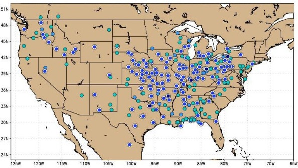
© News4jax.comLocations approaching or surpassing record temperatures on Wednesday morning.
Even Florida didn't escape the icy grip.
The thermometer at Jacksonville International Airport plummeted down to 27° Wednesday morning breaking the old record of 28° in 2008. Thursday's record of 30° also appears to be in jeopardy; a record that dates back to 1873, or 141 years ago.
Even the snow covering the ground is amazing. Roughly
50.4 percent of the lower 48 was covered with snow -- more than
double the amount normally seen for this time of year. At this exact same time last year, just a scant 12.1 percent of the country had snow on the ground. Check out the maps below from Tuesday's snow cover versus exactly one year ago.
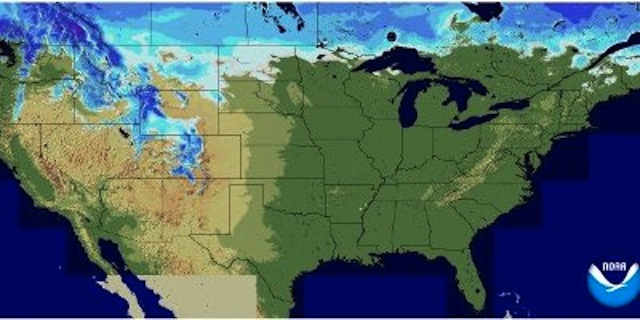
Snow cover 2013
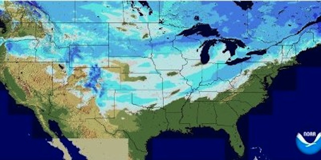
Snow cover 2014
Jeff Masters is meteorology director at the online site Weather Underground. He says the low temperatures are January-like instead of what's normal for November. He says it's 15 degrees to 35 degrees below average over a big chunk of the country, thanks to arctic air.
According to the Climate Prediction Center
1,998 cold weather records were set over the past seven days with 1,360 of those records being low max highs. That means that the temperature was the coldest day time high ever observed for that day. Seen above are the records just from Tuesday alone.
Things are expected to moderate over the next few days with temperatures in Jacksonville climbing to near 80 degrees by early next week. However, the forecast models do indicate more very cold air diving down in the next 10 days. For those that are traveling for the Thanksgiving holiday.
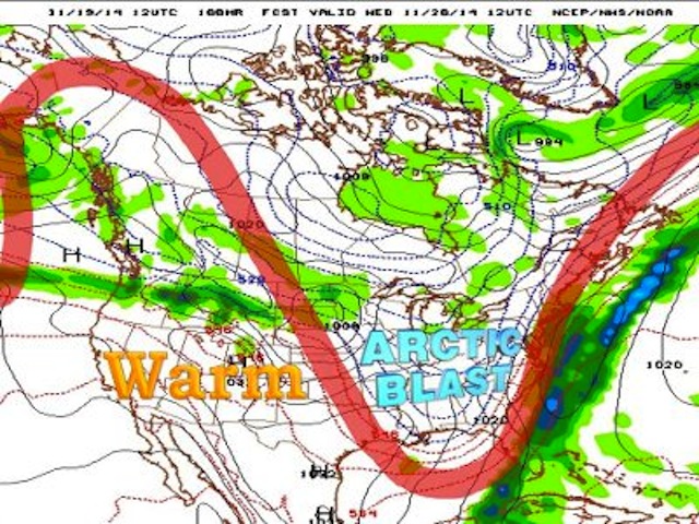
© News4jax.comWednesday's forecast
The top image is Wednesday's forecast. Keep in mind this is still a week away. Nonetheless, the model is indicating another strong arctic front diving into the deep south bring very cold conditions to the southeast and Florida.
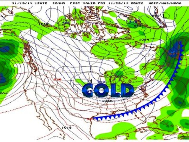
© News4jax.comThursday's forecast
By Thanksgiving Day, as seen in the second image, the first front moves out while another begins to dig into the central plains. This will provide a reinforcing shot of very cold air into the US by the time everybody gets ready to head back home the following weekend. Bottom line, the above images are a snapshot of what could happen.
That's still a long ways out and we'll continue to refine the forecast over the next few days. I must emphasis that there are other models that are showing far warmer conditions. Either way, it could be a stormy pattern across the nation bringing heavy rains and snows to parts of the Midwest so it's important for you to check back in later this week and weekend.
Reader Comments
to our Newsletter