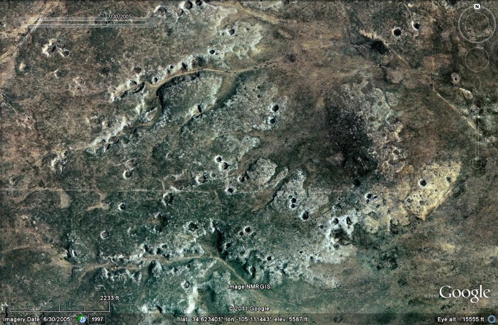
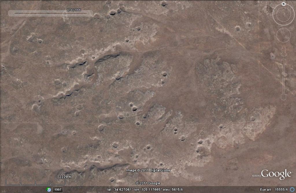
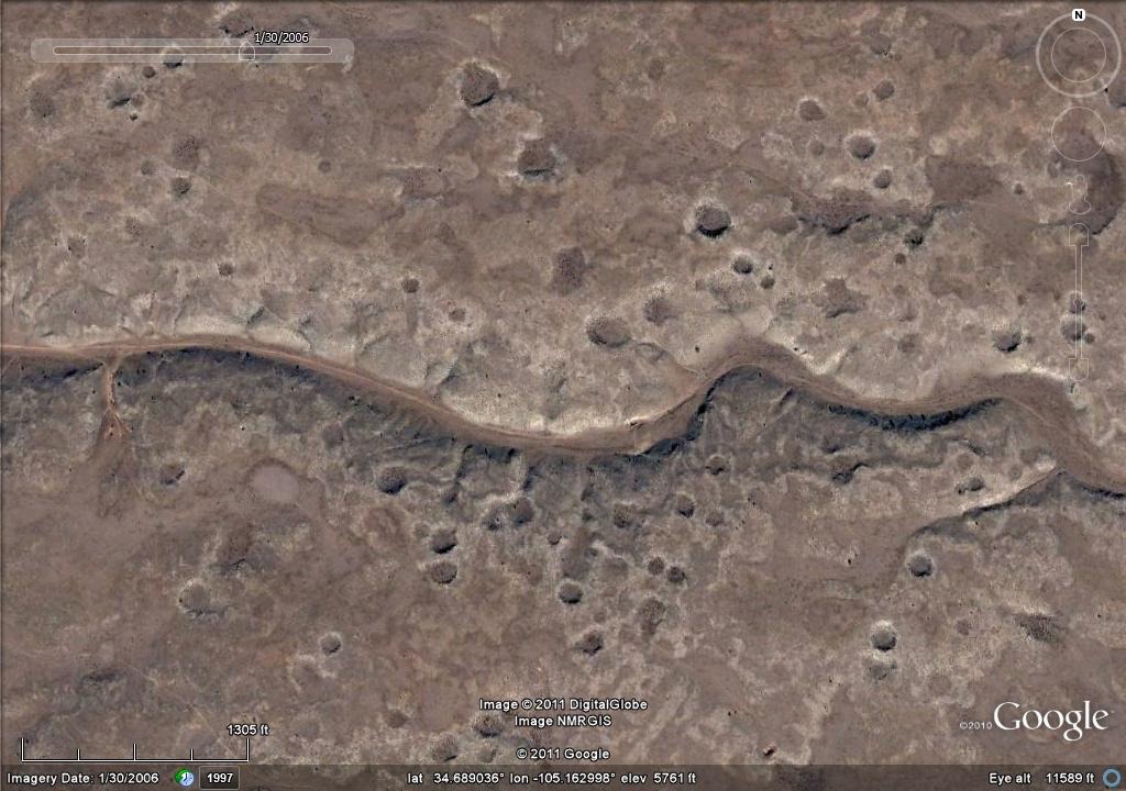
In the image below we see a small part of that area near Vaughn, New Mexico. Using Google Earth's historical image feature, we can view the same place from about 15,000 feet, in images taken at different times of the year.
As you can see, there are numerous craters. You get a different set of colors in the late summer.
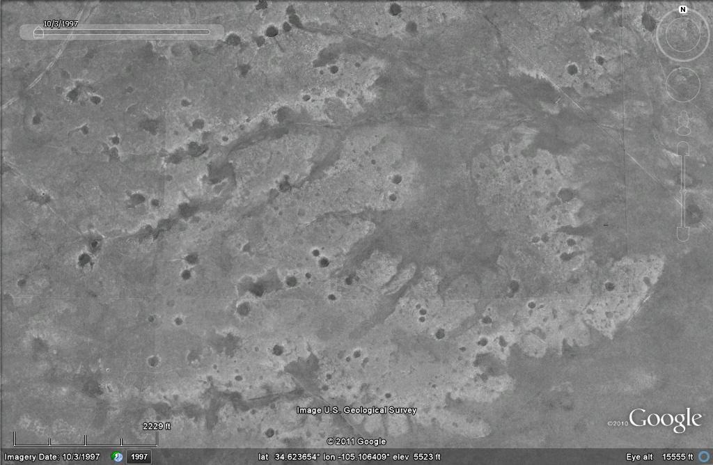
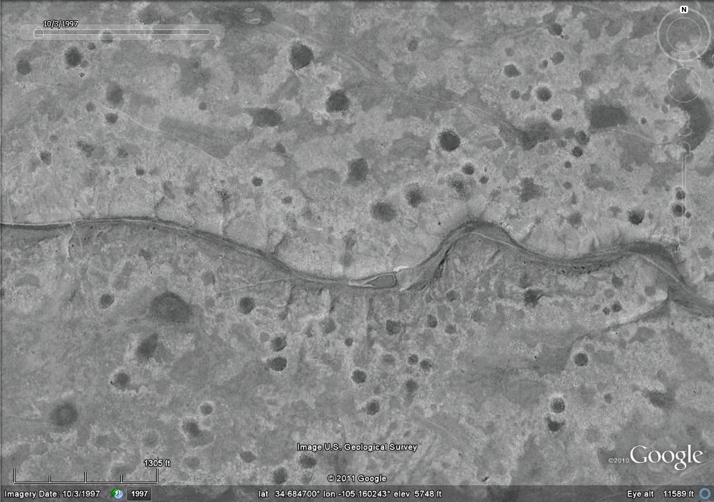
The early black & white images are sometimes even more telling.
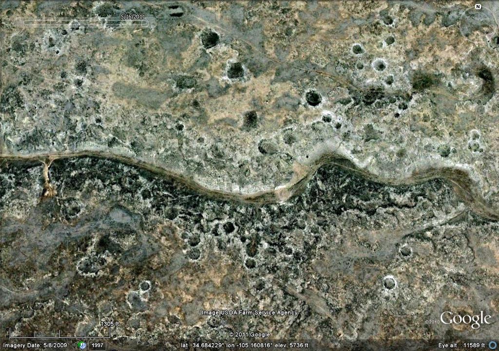
These next few are little closer to Vaughn.
Here it is in the late summer.
And in black & white.
Crater fields of comparable fragment sizes can be found in scattered, locally dense, clusters all the way to central Texas.
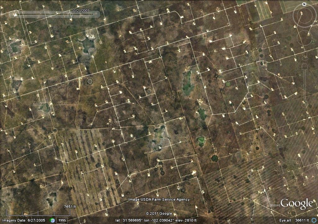
Anyone can Google up some images of the Odessa crater, in west Texas. But the big mystery I'm struggling with is, what about all the others? In the world according to Google Earth, the Odessa crater is only one of thousands liberally scattered among the oil fields of west Texas. In the image you see below, the white lines are dirt roads about 7, or 8, meters wide. And each of the clearings that show up as little rectangles of a half an acre, or so, are the location of an oil well pump.
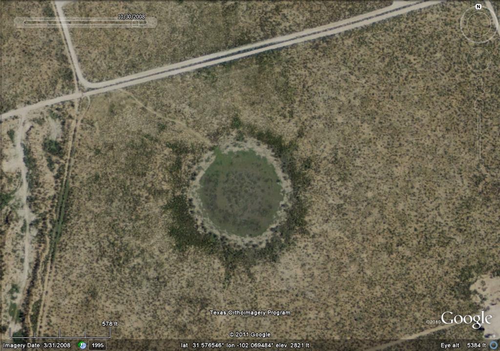
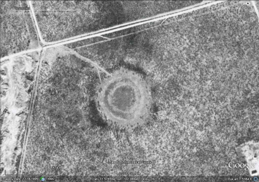
Let's zoom in close to one of them. It's almost 190 meters wide.
The early black & white view is interesting too.
On any other planetary surface in the solar system no one would hesitate to trust their eyes, and call these these what they look like: impact craters.
I asked NASA's David Morrison what he thought of these things. He expressed his doubts that so many craters could be all the same age. He said he thought that a cluster impact event would be "Highly unlikely". Under the prevailing uniformitarian/gradualist geophysical paradigm, his views are typical of most mainstream planetary scientists.
But in March, 2010, W. M. Napier published a paper in the journal Monthly Notices of the Royal Astronomical Society, and titled, "Paleolithic extinctions and the Taurid Complex". In it professor Napier points out that:
"The fragmentation of comets is now recognized as a major route of their disintegration, and this is consistent with the numerous sub-streams and co-moving observed in the Taurid complex."And in an earlier 2009 paper by professor Napier, and titled "Comets, Catastrophes, and Earth's History" we read,
"The evidence that an exceptionally large (50-100 km) comet entered a short-period, Earth-crossing orbit during the upper Paleolithic, and underwent a series of disintegrations, now seems compelling. The idea is not new, but it has been strengthened by an accumulation of evidence from radar studies of the interplanetary environment, from the LDEF experiment, from numerical simulations of the Taurid complex meteoroids and 'asteroids', and from the latter's highly significant orbital clustering around Comet Encke.Most of the academic community assume that large clusters of cometary debris don't hit the Earth. At least, not in the geologically recent past. And they will entertain almost any fantastical theory for the formation of these depressions; as long as that theoretical geologic process does not involve a sudden catastrophic impact event. When looking for answers, the typical party line is that they are all probably karst sinkholes, because they are all in limestone.
The disintegration of this massive Taurid Complex progenitor over some tens of thousands of years would yield meteoroid swarms which could easily lead to brief, catastrophic episodes of multiple bombardment by sub-kilometer bolides, and it is tempting to see the event at ∼ 12,900 BP as an instance of this. Whether it actually happened is a matter for Earth scientists, but from the astronomical point of view a meteoroid swarm is a much more probable event than a 4 km comet collision."
But there's just too darn many of them. And in too large a variety of terrains. Any given karst sinkhole is representative of a partial collapse of a much larger cave system beneath. And if we work from the uniformitarian postulate that these holes in the ground appeared, over a great span of time, our thinking is still stuck in a box. They are all in exactly the same almost pristine condition. So it's completely non sequitur to say they represent a long series of repeated events.
There are many thousands of them, in many different terrains. They can be found in a large variety of sizes in a vast region that includes almost all of eastern New Mexico, and West Texas. And they average about 100 meters in diameter.
Take your pick. Which is more plausible? A giant series of inter-connecting cave systems covering tens of thousands of square miles, with too many large sinkholes as big as a large sports stadium, all breaking the surface, and collapsing, at nearly the same time to count? Or the giant crater fields caused by the almost simultaneous, late Pleistocene - early Holocene impacts of a very large cluster of cometary fragments?
I've been asking around, and digging for evidence that someone has actually done some real science on these things. And all I've been able to get are wimpy answers that begin with; "Well, most geologists agree that______", or words to that effect. Heck, I don't care what they've all decided to agree about. I want to know what they've proven.
As for me, and until proven otherwise, I prefer to trust my own eyes. Those surfaces we see those things in all date to the late Pleistocene. And I'm working from the postulate that they are related to the impact storms of the Younger Dryas Impacts.
There's a few more to be seen in this gallery called Craterfield.


Very compelling photos. It is amazing how the establishment sometimes (most-times) seems to have great difficulty with objective reality both right and left.
Keep up the good work.