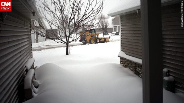
A blizzard warning, issued by the National Weather Service, stretched from South Dakota to Wisconsin and down to Missouri and Illinois. The storm was expected to dump between 15 and 20 inches of snow in some locales.
The storm will likely gain strength during Saturday, before bearing down on the Chicago, Illinois, area, the weather service said.
Even before the current storm, Minneapolis and St. Paul, Minnesota, this season have had 16.7 inches of snow as of the first week of December. Some areas to the west and south have had more, including 22.9 inches in Chanhassen, the National Weather Service said.
More snow came Saturday, with another 7 to 11 inches forecast through the afternoon. The precipitation should taper off by evening, the weather agency said, with temperatures dropping to 8 degrees below zero.
Minnesota road conditions
By noon, the Minnesota State Patrol reported on its Twitter page that 319 vehicles had spun out or gotten into accidents statewide, including 198 in the Twin Cities.
"We're experiencing very heavy snowfall, [but] our plows are out and they holding their own," said Lt. Eric Roeske. "We're dealing with the problems as they occur. But it is tough getting around right now for everyone."
The storm even stranded the New York Giants football team, which is scheduled to play the Minnesota Vikings on Sunday in Minneapolis. The Giants have been stuck at Kansas City International Airport since 12:30 p.m., said team spokesman Peter John-Baptiste, and don't know when it will be able to head north.
Some of the worst conditions in Minnesota were in the southern parts of the state, said Roeske. Blowing snow contributed to whiteout conditions, forcing authorities to temporary pull plows off the road and close several freeways.
South Dakota road conditions
Several roads in central and western Minnesota, including parts of Interstate 90 to the South Dakota border, also had been closed. South Dakota Highway Patrol Captain Kevin Joffer noted that there was an active travel advisory on I-90 in that state due to near-zero visibility.
Some 75 miles of Interstate 29 from Sioux Falls, South Dakota, south to the Iowa border were closed to all traffic as of 1 p.m., said Joffer.
Several people had been injured in South Dakota in accidents caused by the snow, he added, but there were no fatalities.
A blizzard warning also was in effect for most of Iowa through 9 a.m. Sunday, with the National Weather Service predicting conditions would continue to deteriorate.
Iowa road conditions
Between 2 and 4 inches had fallen as of 1:15 p.m., with another 5 to 7 inches expected to accumulate before the storm was done. The agency said it was expecting sustained northwest winds of 30 to 40 mph, with 55 mph gusts.
Bone-chilling temperatures were also a major concern, across the region. Wind chills -- which takes into account the wind, in calculating what it really feels like outside -- were forecast, for instance, to plummet as low as 35 degrees below zero in parts of Iowa.
Even Milwaukee, Wisconsin, on the shores of Lake Michigan, was facing blizzard conditions. Still, some parts of Wisconsin initially saw a mix of precipitation types, from rain to the south and southeast and a mix of rain, snow, sleet and freezing rain to the north and west. The National Weather Service predicted snow would dominate.


Reader Comments
to our Newsletter